The lakes of the Emparis plateau - Hiking from Besse-en-Oisans
Add to my favorites

Caution! Zone of vigilance near the route
Mizoen - du 15/06/2026 au 05/10/2026 In progress
Rif tord - du 01/06/2026 au 15/10/2026 In progress
La Quarlie - du 01/06/2026 au 15/10/2026 In progress
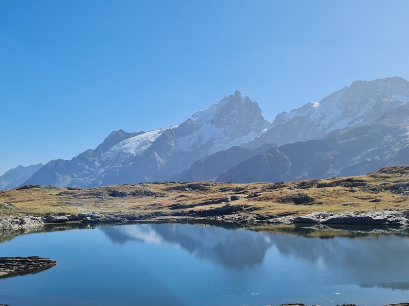
On this 1,060-meter hike, discover the endless meadows of the Plateau d'Emparis, adorned with marshes, lakes and flowers of every color. All with panoramic views of the Meije, the Grandes Rousses and the Aiguilles d'Arves!
The characteristics of the route.

Besse-en-Oisans (38)
- Distance 19.1 km
- Elevation gain 1140 m
- Elevation lost 1140 m
- Min. elevation 1555 m
- Max. elevation. 2455 m
- Marking Yes
TECHNICAL INFORMATION
Start: Parking Beyet (at the end of the village of Besse).
Ascent: 1,060 m
Duration round trip: 5 h outward journey and 4 h return journey
Return distance: 18.5 km
Level: Difficult
MAP AND TOPO
IGN TOP 25 map 3335 ET (Le Bourg-d'Oisans - L'Alpe d'Huez)
Topo map OBP n°3 (Oisans au Bout des Pieds)
ITINERARY
Start at the Beyet parking lot on the outskirts of the village of Besse.
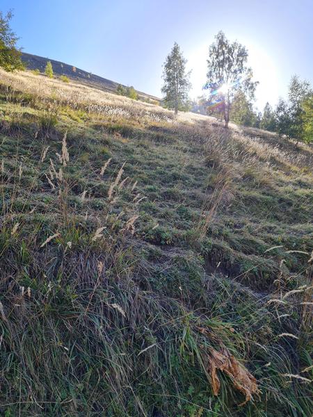
Walk straight on for about 2km to the municipal bivouac area at Le Gay. Walk past the bivouac area, take the track, then take the path that climbs to your left. The GR54 signs indicate that you're on the right track. The climb to the Col Saint George (700 m ascent) takes around 2h30.
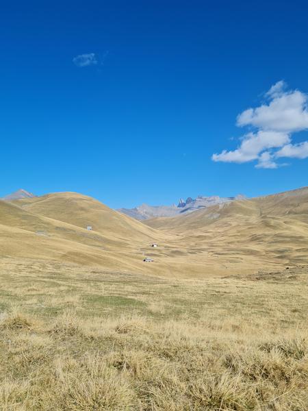
Once at Col Saint George, the climb gives way to a gradual descent to the center of the Plateau ("Plateau d'Emparis" on the yellow signs) over about 2 km. Here, you'll pass close to the Rif Tort marsh and move through endless meadows that resemble Mongolian steppes.
Once you've reached the center of the Emparis plateau, head up towards the Col du Souchet.
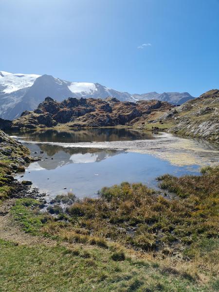
Once at Col du Souchet, leave the GR and head for the lakes: first follow Lac Lérié. If you're lucky, you'll be able to admire the reflection of the Meije glacier in the lakes.
After Lac Noir, head for the center of the Plateau d'Emparis, then return to Besse on the GR.
THINGS TO SEE
- Plateau d'Emparis
- Marais du Rif tort
- Lac Noir
- Lac Lérié
NEARBY ATTRACTIONS
- Besse village
- Maison des AlpagesMarking : Follow the red and white signs (GR54) to Col du Souchet, then follow the yellow PDIPR signs (to Lac Lérié and Lac Noir).Good plans : The Emparis plateau is one of France's largest mountain pastures! Before your hike, please find out what to do in the event of an encounter with herd protection dogs.Admission fee : Free access.Opening : From 01/05 to 31/10 daily. Subject to favorable snow and weather conditions.Warning : As this route is potentially subject to severe damage due to major weather events and its viability may be uncertain, please enquire before embarking on it.
Start: Parking Beyet (at the end of the village of Besse).
Ascent: 1,060 m
Duration round trip: 5 h outward journey and 4 h return journey
Return distance: 18.5 km
Level: Difficult
MAP AND TOPO
IGN TOP 25 map 3335 ET (Le Bourg-d'Oisans - L'Alpe d'Huez)
Topo map OBP n°3 (Oisans au Bout des Pieds)
ITINERARY
Start at the Beyet parking lot on the outskirts of the village of Besse.
Walk straight on for about 2km to the municipal bivouac area at Le Gay. Walk past the bivouac area, take the track, then take the path that climbs to your left. The GR54 signs indicate that you're on the right track. The climb to the Col Saint George (700 m ascent) takes around 2h30.
Once at Col Saint George, the climb gives way to a gradual descent to the center of the Plateau ("Plateau d'Emparis" on the yellow signs) over about 2 km. Here, you'll pass close to the Rif Tort marsh and move through endless meadows that resemble Mongolian steppes.
Once you've reached the center of the Emparis plateau, head up towards the Col du Souchet.
Once at Col du Souchet, leave the GR and head for the lakes: first follow Lac Lérié. If you're lucky, you'll be able to admire the reflection of the Meije glacier in the lakes.
After Lac Noir, head for the center of the Plateau d'Emparis, then return to Besse on the GR.
THINGS TO SEE
- Plateau d'Emparis
- Marais du Rif tort
- Lac Noir
- Lac Lérié
NEARBY ATTRACTIONS
- Besse village
- Maison des AlpagesMarking : Follow the red and white signs (GR54) to Col du Souchet, then follow the yellow PDIPR signs (to Lac Lérié and Lac Noir).Good plans : The Emparis plateau is one of France's largest mountain pastures! Before your hike, please find out what to do in the event of an encounter with herd protection dogs.Admission fee : Free access.Opening : From 01/05 to 31/10 daily. Subject to favorable snow and weather conditions.Warning : As this route is potentially subject to severe damage due to major weather events and its viability may be uncertain, please enquire before embarking on it.
Area : Oisans
Report a problem
Features of the application :
- Location and orientation on detailed maps thanks to the GPS of your smartphone
- Description of routes and points of interest on the route
- Photo gallery by route
- Detailed elevation profile
- Route tracking alert to warn you if you stray from the route
- Send predefined messages by SMS to your contacts
- Emergency module: trigger a call or send an emergency SMS in case of problem
- Agenda: access to events organized in the department
- News: find in the application the latest news on the web portal
- Adding achievements
- Add reports in case of problems encountered on the routes
- Share on social networks
Add your time and share your feelings
Services nearby

Maison Départementale des Alpages de l'Isère
Besse-en-Oisans

Tourist office of le Ferrand
Besse-en-Oisans

Refuge Les Clôts
Mizoën
Refuge du Fay
Mizoën
Refuge Les Mouterres
Mizoën



Follow us on
the digital trails
the digital trails





The Isère Outdoor application was created
by the Département de l'Isère
Infos & contact
Conseil départemental de l'Isère
7 rue Fantin Latour
CS 41096
38 022 Grenoble cedex 1
Tel. 04 76 00 38 38
 Isère Outdoor - Parcours - The lakes of the Emparis plateau - Hiking from Besse-en-Oisans
Hello, world! This is a toast message.
Isère Outdoor - Parcours - The lakes of the Emparis plateau - Hiking from Besse-en-Oisans
Hello, world! This is a toast message.
Isère Outdoor - Parcours - The lakes of the Emparis plateau - Hiking from Besse-en-Oisans
Hello, world! This is a toast message.


OK
Annuler