Randonnée pédestre du Temple de Vaulx
Add to my favorites

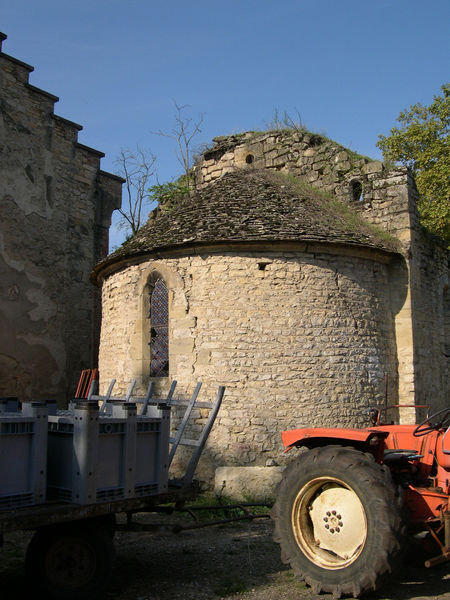
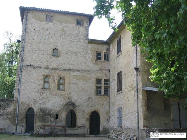
Randonnée vers la Commanderie du Temple de Vaulx édifiée par les Templiers après la première croisade.
The characteristics of the route.

L'Isle d'Abeau (38)
- Distance 5.8 km
- Elevation gain 120 m
- Elevation lost 120 m
- Min. elevation 224 m
- Max. elevation. 294 m
- Duration (depending on pace) 1h50
- Marking Yes
Equipments : Car park, Admission fee : Free access.Opening : All year round.
Area : Porte de l'Isère
Report a problem
Website Features of the application :
- Location and orientation on detailed maps thanks to the GPS of your smartphone
- Description of routes and points of interest on the route
- Photo gallery by route
- Detailed elevation profile
- Route tracking alert to warn you if you stray from the route
- Send predefined messages by SMS to your contacts
- Emergency module: trigger a call or send an emergency SMS in case of problem
- Agenda: access to events organized in the department
- News: find in the application the latest news on the web portal
- Adding achievements
- Add reports in case of problems encountered on the routes
- Share on social networks
BenBJ
finished in 01:23:30
The 2023/02/17
En savoir plus
Ajouter votre chrono et partager vos sensations
2023/02/17 01:23:30
BenBJ
BenBJ
Balade très agréable et familiale. Juste une portion de petite route mais qui dessert le golf donc un peu passante quand il fait beau!
2023/02/17 01:23:30
BenBJ
BenBJ
Balade très agréable et familiale. Juste une portion de petite route mais qui dessert le golf donc un peu passante quand il fait beau!
Services nearby

Office de Tourisme CAPI Porte de l'Isère
Bourgoin-Jallieu

Musée de Bourgoin-Jallieu
Bourgoin-Jallieu

Espace naturel sensible de l'étang de Fallavier et Vallon du Layet
Saint-Quentin-Fallavier
Musée de La Vie Rurale
Saint-Quentin-Fallavier
Crémieu - Balcons du Dauphine Tourist Information Office
Crémieu


Information updated on 2025-01-28 by Office de Tourisme CAPI - Porte de l'Isère


Follow us on
the digital trails
the digital trails


![]()
The Isère Outdoor application was created
by the Département de l'Isère
Infos & contact
Conseil départemental de l'Isère
7 rue Fantin Latour
CS 41096
38 022 Grenoble cedex 1
Tel. 04 76 00 38 38
 Isère Outdoor - Parcours - Randonnée pédestre du Temple de Vaulx
Hello, world! This is a toast message.
Isère Outdoor - Parcours - Randonnée pédestre du Temple de Vaulx
Hello, world! This is a toast message.
Isère Outdoor - Parcours - Randonnée pédestre du Temple de Vaulx
Hello, world! This is a toast message.


OK
Annuler