N°10 Le Conest VTT - Noir
Add to my favorites

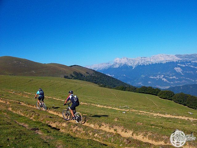
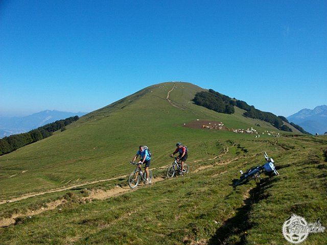
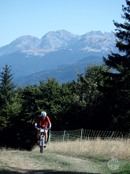
A Beautiful itinerary where you will brave a big difference in height withe beautifull vieuw points on the high mountain pasture of the Conest.
The characteristics of the route.

Pierre-Châtel (38)
- Distance 39.8 km
- Elevation gain 1410 m
- Elevation lost 1410 m
- Min. elevation 846 m
- Max. elevation. 1603 m
- Duration (depending on pace) 4h
- Marking Yes
After a raining period the fog and mud can make the trip dangerous, you better wait and plan your trip on a beautifull day.Equipments : Car park, Public WC, Picnic area, Admission fee : Free access.
Area : Matheysine
Report a problem
Website Features of the application :
- Location and orientation on detailed maps thanks to the GPS of your smartphone
- Description of routes and points of interest on the route
- Photo gallery by route
- Detailed elevation profile
- Route tracking alert to warn you if you stray from the route
- Send predefined messages by SMS to your contacts
- Emergency module: trigger a call or send an emergency SMS in case of problem
- Agenda: access to events organized in the department
- News: find in the application the latest news on the web portal
- Adding achievements
- Add reports in case of problems encountered on the routes
- Share on social networks
Add your time and share your feelings
Services nearby

Musuem "La Mine Image"
La Motte-d'Aveillans

Belvédère Olivier Messiaen
Saint-Théoffrey

Maison du Tourisme de La Motte d'Aveillans
La Motte-d'Aveillans
Museum "Musée Matheysin"
La Mure
Alpe du Grand Serre Tourist Office
Alpe Du Grand Serre


Information updated on 2024-08-12 by Matheysine Tourisme


Follow us on
the digital trails
the digital trails


![]()
The Isère Outdoor application was created
by the Département de l'Isère
Infos & contact
Conseil départemental de l'Isère
7 rue Fantin Latour
CS 41096
38 022 Grenoble cedex 1
Tel. 04 76 00 38 38
 Isère Outdoor - Parcours - N°10 Le Conest VTT - Noir
Hello, world! This is a toast message.
Isère Outdoor - Parcours - N°10 Le Conest VTT - Noir
Hello, world! This is a toast message.
Isère Outdoor - Parcours - N°10 Le Conest VTT - Noir
Hello, world! This is a toast message.


OK
Annuler