MTB track - Rhodos
Add to my favorites

Caution! Zone of vigilance near the route
Tétras lyre - hiver - du 01/01/2026 au 30/04/2026 In progress
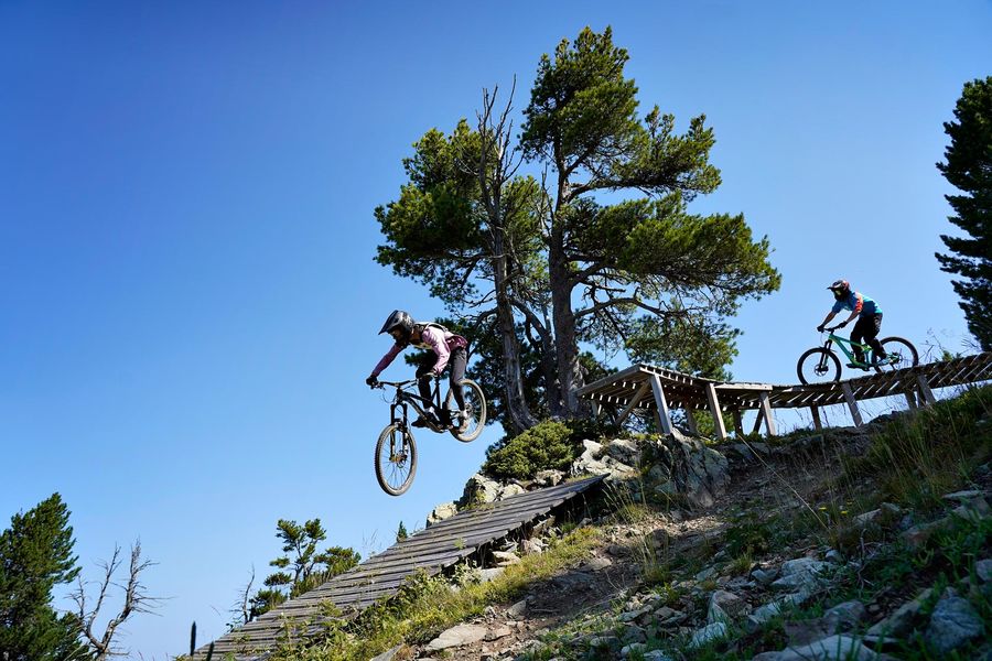
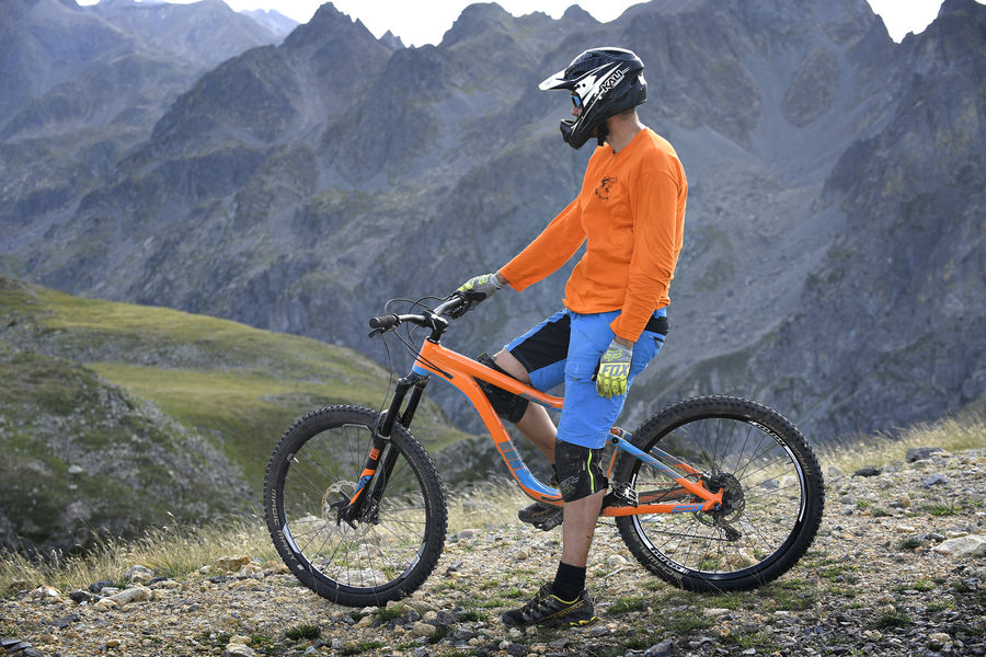
Difficult mountain bike track (red level) in Chamrousse 1750.
Departure: at the top of the Bachat chairlift of Chamrousse 1750 (1700m)
Arrival: Chamrousse 1750 - Roche-Béranger
Time : 8 minutes
The characteristics of the route.
Chamrousse (38)
- Distance 1.9 km
- Elevation gain 0 m
- Elevation lost 280 m
- Min. elevation 1743 m
- Max. elevation. 2023 m
- Duration (depending on pace) 0h08
- Marking Yes
Former track of the Downhill Regional Cup, redesigned to make it faster with a chain of jumps, roots, rocky slabs.
Rolls it all up.
Downhill machines / all-terrain scooters not allowed.Equipments : Public WC, Parking nearby, Opening : From 01/07 to 31/08. Bachat Bouloud chairlift timetable summer 2023 : 9h30-12h45 and 13h15-16h30.
Rolls it all up.
Downhill machines / all-terrain scooters not allowed.Equipments : Public WC, Parking nearby, Opening : From 01/07 to 31/08. Bachat Bouloud chairlift timetable summer 2023 : 9h30-12h45 and 13h15-16h30.
Report a problem
Website Features of the application :
- Location and orientation on detailed maps thanks to the GPS of your smartphone
- Description of routes and points of interest on the route
- Photo gallery by route
- Detailed elevation profile
- Route tracking alert to warn you if you stray from the route
- Send predefined messages by SMS to your contacts
- Emergency module: trigger a call or send an emergency SMS in case of problem
- Agenda: access to events organized in the department
- News: find in the application the latest news on the web portal
- Adding achievements
- Add reports in case of problems encountered on the routes
- Share on social networks
Add your time and share your feelings
Services nearby

Chamrousse Tourist Office
Chamrousse

Arselle Peatbog (Preserved Natural Area)
Chamrousse

Romanche Museum
Livet-et-Gavet
Office Thermal et Touristique d'Uriage-les-Bains
Saint-Martin-d'Uriage

Refuge de la Pra
Revel


Information updated on 2024-10-04 by Office du Tourisme de Chamrousse


Follow us on
the digital trails
the digital trails


![]()
The Isère Outdoor application was created
by the Département de l'Isère
Infos & contact
Conseil départemental de l'Isère
7 rue Fantin Latour
CS 41096
38 022 Grenoble cedex 1
Tel. 04 76 00 38 38
 Isère Outdoor - Parcours - MTB track - Rhodos
Hello, world! This is a toast message.
Isère Outdoor - Parcours - MTB track - Rhodos
Hello, world! This is a toast message.
Isère Outdoor - Parcours - MTB track - Rhodos
Hello, world! This is a toast message.


OK
Annuler