The rock of Comboire - Family walk
Add to my favorites

Known for its ancient fort, the Comboire rock is an island of greenery protected from the galloping urbanization of the neighboring communes. This 2-hour loop marked out in yellow allows you to discover a rich natural and historical heritage.
The characteristics of the route.

Claix (38)
- Distance 5.8 km
- Elevation gain 250 m
- Elevation lost 250 m
- Min. elevation 350 m
- Max. elevation. 521 m
- Duration (depending on pace) 2h15
- Marking Yes
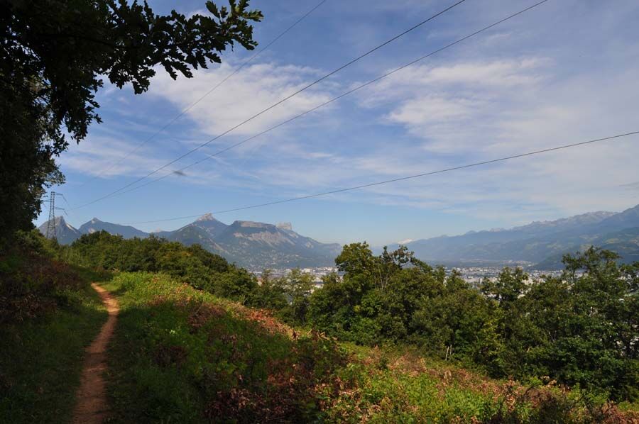
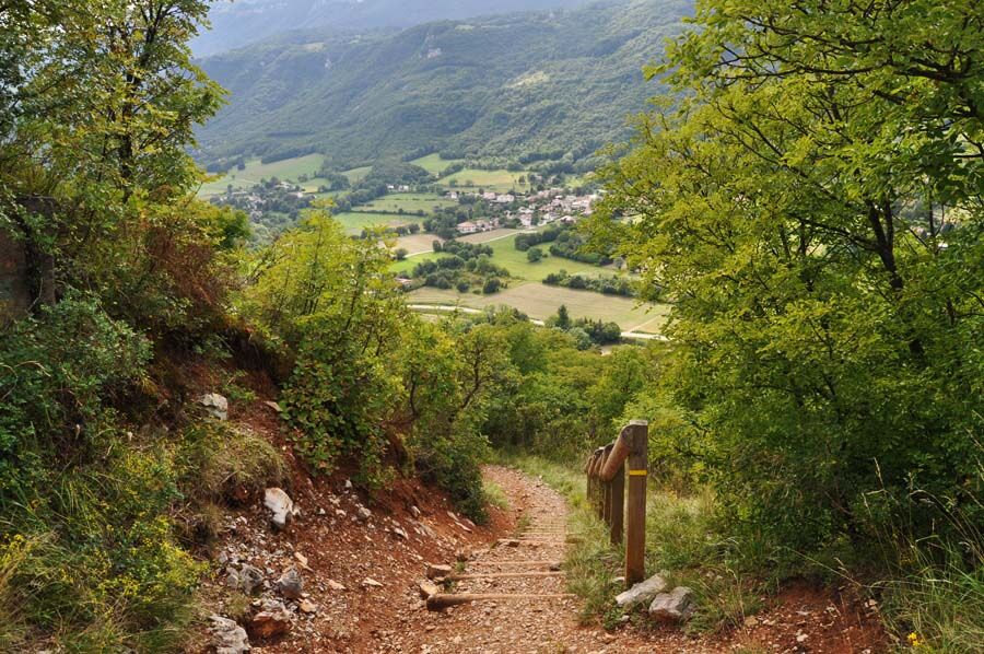
Delicate passages : This walk is partially done on the edge of cliffs, stay on the marked paths.Admission fee : Free access.Opening : All year round.Step by step description : When you get off bus 58 at the "Col de Comboire" stop, you'll see a yellow sign indicating the direction to Les Cimentiers, which you'll follow. A hundred metres after leaving the road, turn right, heading south, to join the path leading up to "Les Cimentiers", towards the Belvédère de Comboire. You'll need to climb a hundred metres or so on a fairly steep path to reach the top of the rock. Depending on the season, you'll be able to observe the Mediterranean vegetation, such as the Montpellier maples with their characteristic three-lobed leaves. At the top, an exceptional panorama of the Grenoble basin and surrounding mountains awaits you. From here, the long rocky ridge of Comboire offers a relaxing stroll of almost 2 km, with the conurbation to the east and the limestone cliffs of the Vercors to the west as a backdrop. At the northern end of the loop, near Les Nalettes in Seyssins, the trail begins a steep descent, before gradually turning south along a wide, shady track. Follow the signs for Les Cimentiers to rejoin the path back to the start, then the road, where a bus will take you away from this area, so rural yet so close to the city, with no doubt a few regrets.loop via the summit of the Comboire rock.
FORT DE COMBOIRE
Built at the end of the 19th century, this is the latest in a series of 6 forts to defend the ancient capital of Dauphiné (the others are Saint Eynard, Murier, Bourcet, montagne de 4 seigneurs and Montavie).
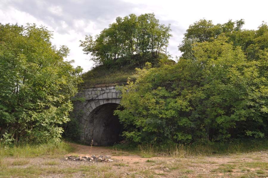
CEMENT STONE QUARRIES
The rock of Comboire conceals a veritable network of underground galleries, dating back to the quarrying of cement stone by the Vicat company, founded by the inventor (Louis Vicat) of cement in 1827.
Area : Grenoble-Alpes Métropole
Report a problem
Website Pdf file Features of the application :
- Location and orientation on detailed maps thanks to the GPS of your smartphone
- Description of routes and points of interest on the route
- Photo gallery by route
- Detailed elevation profile
- Route tracking alert to warn you if you stray from the route
- Send predefined messages by SMS to your contacts
- Emergency module: trigger a call or send an emergency SMS in case of problem
- Agenda: access to events organized in the department
- News: find in the application the latest news on the web portal
- Adding achievements
- Add reports in case of problems encountered on the routes
- Share on social networks
Azrty1234
finished in 00:21:31
The 2024/10/18
En savoir plus
Ajouter votre chrono et partager vos sensations
2024/10/18 00:21:31
Azrty1234
Azrty1234
2024/10/18 00:21:31
Azrty1234
Azrty1234
Services nearby

Point Information Touristique de St Nizier du Moucherotte
Saint-Nizier-du-Moucherotte

Musée Géo-Charles
Échirolles
Espace Histo Bus Dauphinois
Le Pont-de-Claix

Espace naturel sensible de la tourbière du Peuil
Claix
Viscose Museum
Échirolles


Information updated on 2025-05-06 by Office de Tourisme Grenoble Alpes


Follow us on
the digital trails
the digital trails


![]()
The Isère Outdoor application was created
by the Département de l'Isère
Infos & contact
Conseil départemental de l'Isère
7 rue Fantin Latour
CS 41096
38 022 Grenoble cedex 1
Tel. 04 76 00 38 38
 Isère Outdoor - Parcours - The rock of Comboire - Family walk
Hello, world! This is a toast message.
Isère Outdoor - Parcours - The rock of Comboire - Family walk
Hello, world! This is a toast message.
Isère Outdoor - Parcours - The rock of Comboire - Family walk
Hello, world! This is a toast message.


OK
Annuler