Tour de l'Aiguille de Quaix en Chartreuse
Add to my favorites

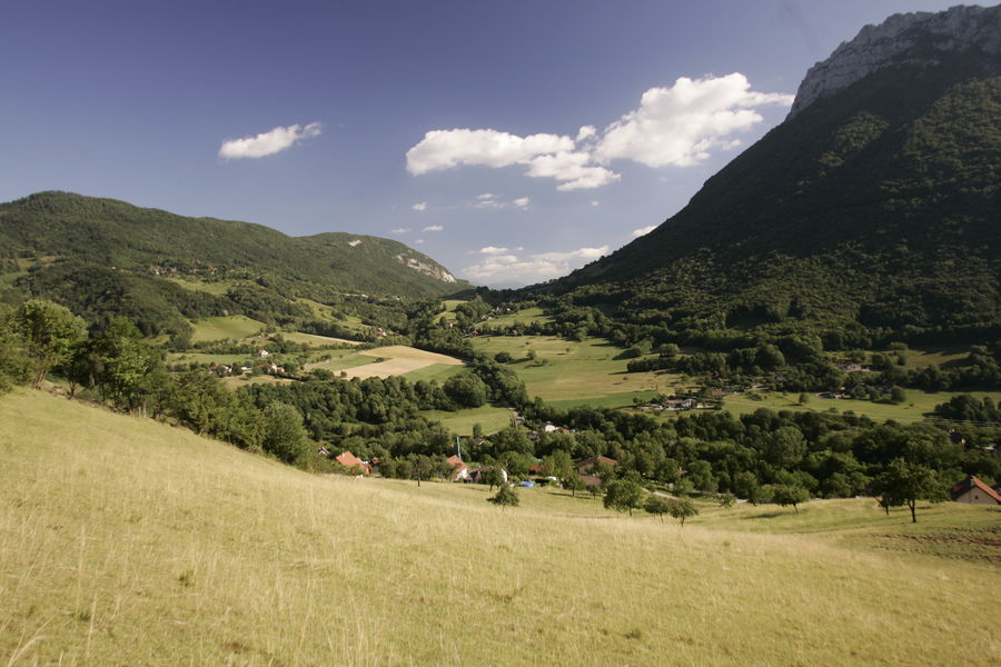
During this forest hike, you will discover another facet of the Chartreuse forests, through a Mediterranean-type forest due to its southern exposure.
Route labeled FFRandonnée

The characteristics of the route.

Quaix-en-Chartreuse (38)
- Distance 8.8 km
- Elevation gain 580 m
- Elevation lost 580 m
- Min. elevation 532 m
- Max. elevation. 1098 m
- Duration (depending on pace) 4h
- Marking Yes
Marking : Departure signs are placed in the villages at parking or public reception points.
To follow your route, posts are set up at crossroads and identifiable by a plate indicating its name and altitude.
Between two posts, markings in paint mark out the path to follow or not. You can also be guided by small staking signs.
Recommended "Walks and hikes in the Chartreuse" card.Equipments : Car park, Admission fee : Free of charge.Opening : From 01/05 to 30/11.
Subject to favorable weather.Step by step description : From Quaix en Chartreuse (parking lot by the town hall and church), take the stairs up to the left of the church to reach La Jars. Continue towards Les Touches, where you take the path to the right towards the Aiguille de Quaix, passing the Mas de Leuilly (l'eurilly = the needle), a former café-auberge. The path climbs steeply on the left of the stream to the Col du Ronzier, where you turn left to reach the Aiguille ridge and admire the view over the valley from the Belvédère de l'Aiguille.
To return, follow the descent towards Les Prés de l'Aiguille and continue along the meadows past Trépaloup towards Quaix en Chartreuse. Return to Les Touches and the outward path to get back to the starting point.
Things to see/do near the route:
- La Casamaures (8km from the start): exhibitions and shows.
- Fort du St Eynard (13km from the start): visit the fort and enjoy exceptional panoramic views.
- Musée d'Art Sacré Contemporain (20km from the start): St Hugues church.
- Grande Chartreuse Museum (23km from start): audio-guided tour.
For further information and ideas, visit chartreuse-tourisme.com/rsf
Information / safety :
- to make the most of your walks and hikes in complete safety, it's a good idea to adopt a few rules and follow a few tips! Before setting off, follow our recommendations and advice on chartreuse-tourisme.com/conseils-rando-trail (or on request from tourist offices).
- A mountain leader is a specialist in mountain fauna and flora, off-trail hiking away from the crowds, local history, alpine and farming traditions, etc. in complete safety! Just ask! Detailed list on chartreuse-tourisme.com/accomp (or at tourist offices).
- You hike under your own responsibility. Chartreuse Tourisme and the tourist offices cannot be held responsible for the itineraries proposed.
Useful numbers :
- Meteo (please consult before setting off): 3250 or www.meteo.fr
- Mountain rescue: 112
Area : Grenoble-Alpes Métropole
Report a problem
Website Pdf file Features of the application :
- Location and orientation on detailed maps thanks to the GPS of your smartphone
- Description of routes and points of interest on the route
- Photo gallery by route
- Detailed elevation profile
- Route tracking alert to warn you if you stray from the route
- Send predefined messages by SMS to your contacts
- Emergency module: trigger a call or send an emergency SMS in case of problem
- Agenda: access to events organized in the department
- News: find in the application the latest news on the web portal
- Adding achievements
- Add reports in case of problems encountered on the routes
- Share on social networks
Add your time and share your feelings
Services nearby

Sappey-en-Chartreuse Tourist Information Center
Le Sappey-en-Chartreuse

Col de Porte
Sarcenas

Musée Hébert
La Tronche
Bastille Tourist Information Center
Grenoble
Mountain Troops Museum
Grenoble


Information updated on 2025-05-06 by Chartreuse Tourisme


Follow us on
the digital trails
the digital trails


![]()
The Isère Outdoor application was created
by the Département de l'Isère
Infos & contact
Conseil départemental de l'Isère
7 rue Fantin Latour
CS 41096
38 022 Grenoble cedex 1
Tel. 04 76 00 38 38
 Isère Outdoor - Parcours - Tour de l'Aiguille de Quaix en Chartreuse
Hello, world! This is a toast message.
Isère Outdoor - Parcours - Tour de l'Aiguille de Quaix en Chartreuse
Hello, world! This is a toast message.
Isère Outdoor - Parcours - Tour de l'Aiguille de Quaix en Chartreuse
Hello, world! This is a toast message.


OK
Annuler