Boucle vélo de Brié-et-Angonnes
Add to my favorites

A loop starting from Tavernolles, Brié et Angonnes.
The characteristics of the route.
Bresson (38)
- Distance 10.1 km
- Elevation gain 230 m
- Elevation lost 230 m
- Min. elevation 359 m
- Max. elevation. 494 m
- Duration (depending on pace) 1h
- Marking No
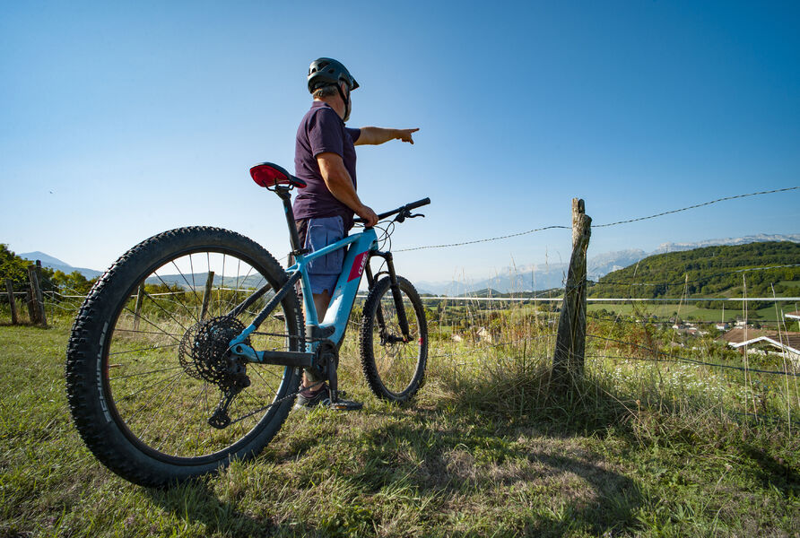
Situated on a major road (the D5) that connects to the Grenoble urban area, the starting point for this loop is very convenient for meeting up, parking and refreshments once the walk is over.
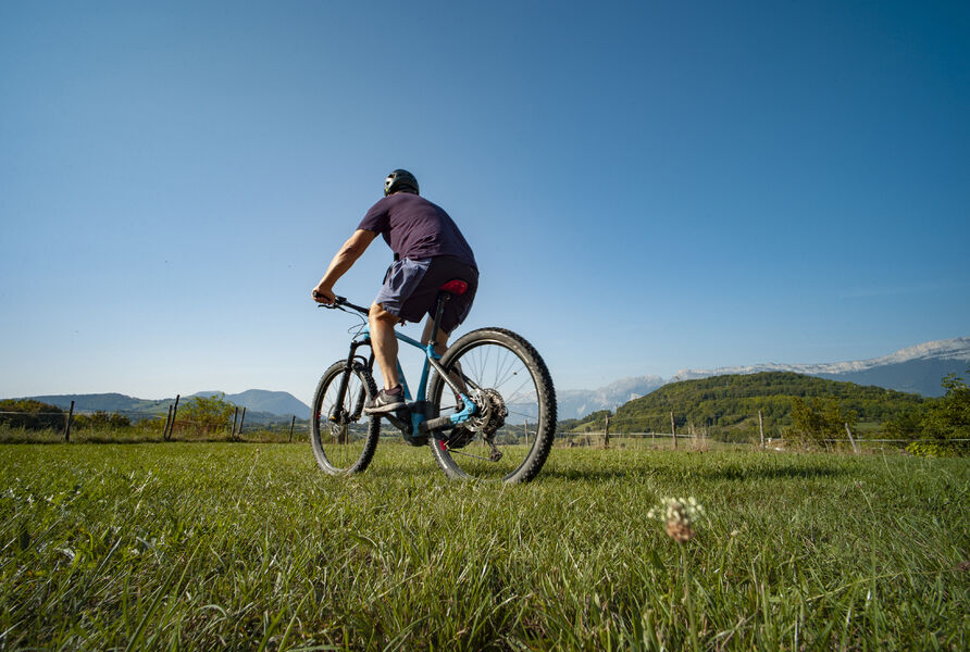
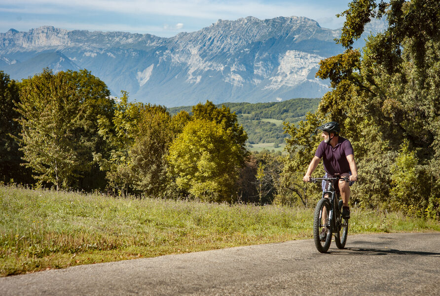
From the center of the hamlet of Tavernolles, you'll quickly gain height before winding your way along quiet country roads. With its moderate gradient, beautiful curves and pleasant descents, this route is suitable for beginners.
With the Vercors Massif as a backdrop, the hamlets of Brié-et-Angonnes wind beneath your wheels in an invigorating alternation of bocage and undergrowth.
This loop takes you in the footsteps of Napoleon. After his escape from Elba and his victory at Laffrey, the emperor was back in power. In Brié-et-Angonnes, he met a young colonel, Charles de la Bédoyère, whose name the park bears today.
From the parking lots along the Tavernolles traffic circle, climb up the D112 - route des Angonnes.
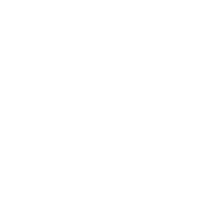
Before setting off down the Chemin de l'Oratoires on your right, take time to admire the line of ridges that opens up before you from the Angonnes chapel parking lot.
Turn left onto the Chemin du Petit Vallon.
Turn right onto the Chemin des Bourrins for 100 m, then left onto the Chemin du Cavin.
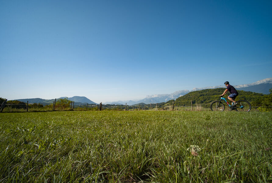
Turn left onto route du Souveyron, which, after passing through a residential area, offers superb views of the surrounding fields and mountains.
Take the Chemin des Metraux on your left and continue along the same road, turning right at the next crossroads.
Keep to the right on the Route d'Uriage and watch out when crossing the Route de Grenoble.
Enjoy the panoramic view across fields and hedges from the route du Mont Rolland and the route de la Croix.
Continue on chemin des Rollands, turning right after the speed bumps, and continue on chemin de Blanchetière and chemin des Lombards.
Turn left onto chemin de l'Egagere.
Return to your starting point by carefully turning right onto the D112 - route de Jarrie. For safety (if you have a suitable bike), take the small path that runs alongside it on the right for a long stretch.Equipments : Parking nearby, Admission fee : Free access.Opening : All year round. Subject to favorable weather.
From the center of the hamlet of Tavernolles, you'll quickly gain height before winding your way along quiet country roads. With its moderate gradient, beautiful curves and pleasant descents, this route is suitable for beginners.
With the Vercors Massif as a backdrop, the hamlets of Brié-et-Angonnes wind beneath your wheels in an invigorating alternation of bocage and undergrowth.
This loop takes you in the footsteps of Napoleon. After his escape from Elba and his victory at Laffrey, the emperor was back in power. In Brié-et-Angonnes, he met a young colonel, Charles de la Bédoyère, whose name the park bears today.
From the parking lots along the Tavernolles traffic circle, climb up the D112 - route des Angonnes.
Before setting off down the Chemin de l'Oratoires on your right, take time to admire the line of ridges that opens up before you from the Angonnes chapel parking lot.
Turn left onto the Chemin du Petit Vallon.
Turn right onto the Chemin des Bourrins for 100 m, then left onto the Chemin du Cavin.
Turn left onto route du Souveyron, which, after passing through a residential area, offers superb views of the surrounding fields and mountains.
Take the Chemin des Metraux on your left and continue along the same road, turning right at the next crossroads.
Keep to the right on the Route d'Uriage and watch out when crossing the Route de Grenoble.
Enjoy the panoramic view across fields and hedges from the route du Mont Rolland and the route de la Croix.
Continue on chemin des Rollands, turning right after the speed bumps, and continue on chemin de Blanchetière and chemin des Lombards.
Turn left onto chemin de l'Egagere.
Return to your starting point by carefully turning right onto the D112 - route de Jarrie. For safety (if you have a suitable bike), take the small path that runs alongside it on the right for a long stretch.Equipments : Parking nearby, Admission fee : Free access.Opening : All year round. Subject to favorable weather.
Area : Grenoble-Alpes Métropole
Report a problem
Website Pdf file Features of the application :
- Location and orientation on detailed maps thanks to the GPS of your smartphone
- Description of routes and points of interest on the route
- Photo gallery by route
- Detailed elevation profile
- Route tracking alert to warn you if you stray from the route
- Send predefined messages by SMS to your contacts
- Emergency module: trigger a call or send an emergency SMS in case of problem
- Agenda: access to events organized in the department
- News: find in the application the latest news on the web portal
- Adding achievements
- Add reports in case of problems encountered on the routes
- Share on social networks
Add your time and share your feelings
Services nearby

Office Thermal et Touristique d'Uriage-les-Bains
Saint-Martin-d'Uriage

The chemistry Museum
Jarrie
Espace Histo Bus Dauphinois
Le Pont-de-Claix
Musée Géo-Charles
Échirolles
Viscose Museum
Échirolles


Information updated on 2024-08-01 by Office de Tourisme Grenoble Alpes


Follow us on
the digital trails
the digital trails


![]()
The Isère Outdoor application was created
by the Département de l'Isère
Infos & contact
Conseil départemental de l'Isère
7 rue Fantin Latour
CS 41096
38 022 Grenoble cedex 1
Tel. 04 76 00 38 38
 Isère Outdoor - Parcours - Boucle vélo de Brié-et-Angonnes
Hello, world! This is a toast message.
Isère Outdoor - Parcours - Boucle vélo de Brié-et-Angonnes
Hello, world! This is a toast message.
Isère Outdoor - Parcours - Boucle vélo de Brié-et-Angonnes
Hello, world! This is a toast message.


OK
Annuler