Boucle vélo Vif - Les Saillants-du-Gua
Add to my favorites

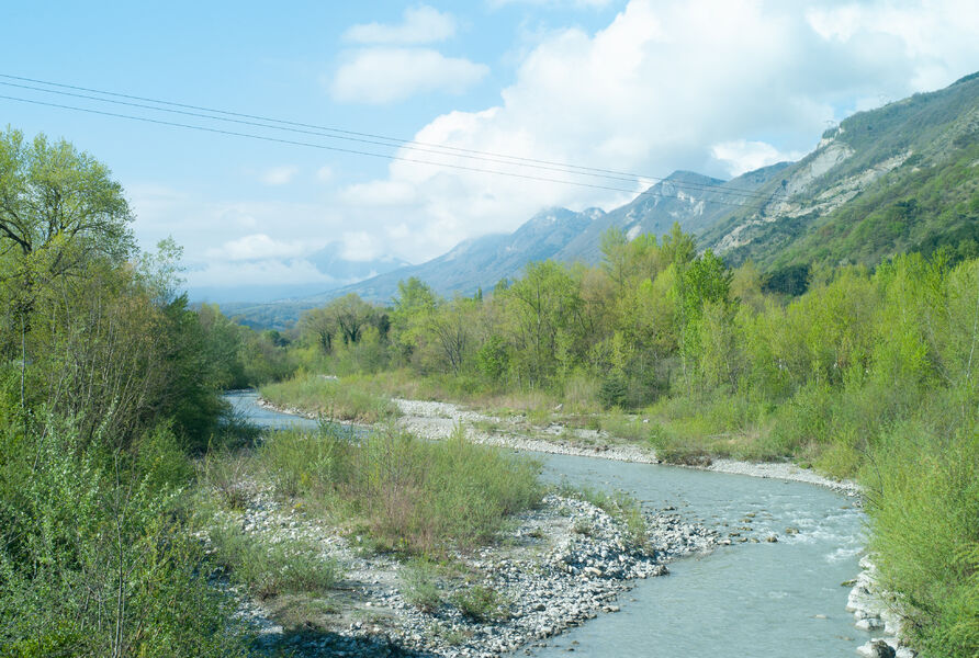
It's a walk along the water's edge, which you begin by skirting the torrent of La Gresse on the way out, and which you ascend on the other bank on the way back. It's a family-friendly walk with no great difficulties.
The characteristics of the route.

Vif (38)
- Distance 8.4 km
- Elevation gain 120 m
- Elevation lost 120 m
- Min. elevation 308 m
- Max. elevation. 421 m
- Duration (depending on pace) 1h
- Marking No
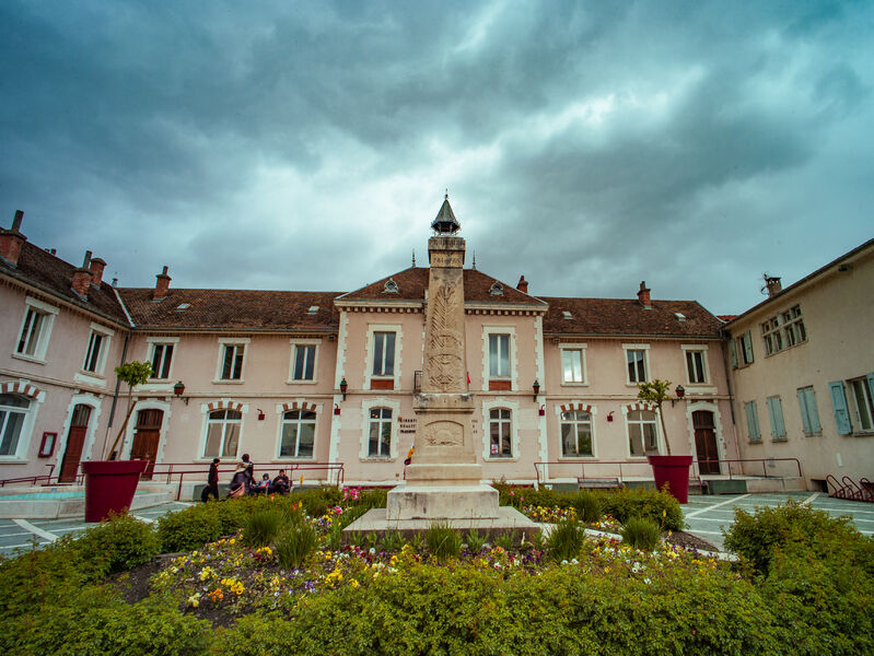
The starting point for this loop is Place de la Libération, which runs alongside Vif town hall and is surrounded by shops. Please note that some parking spaces are free, while others are in the blue zone.
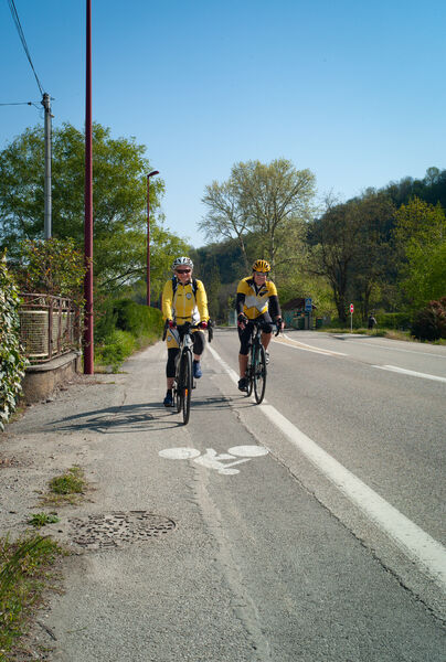
This is a stroll along the water's edge, which you begin by following the torrent of La Gresse on the way out, and which you follow upstream on the other bank on the way back. In between, you'll take the D8, a completely flat but relatively busy road, before moving on to quieter secondary roads with a slightly steeper gradient. It's a family outing with no major difficulties.
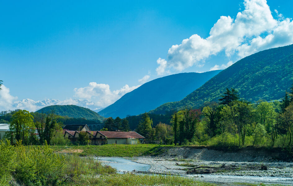
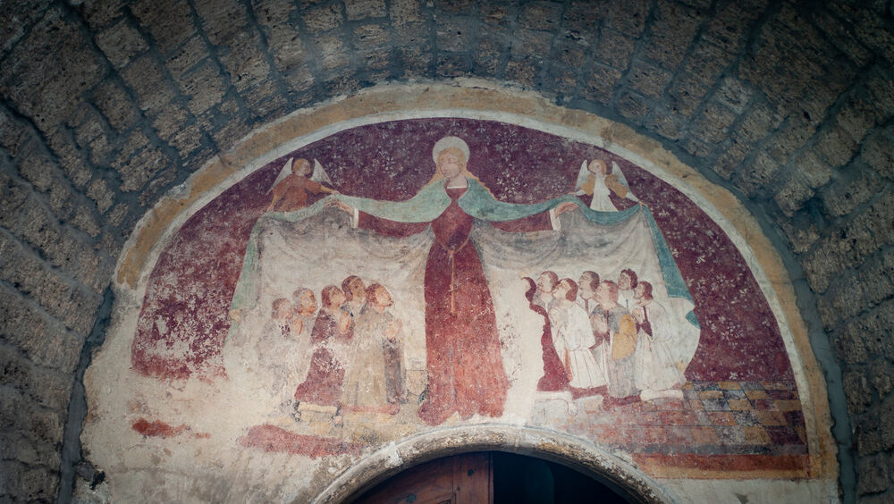
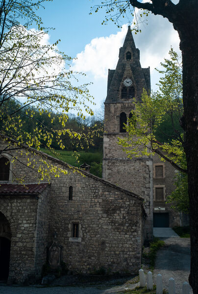
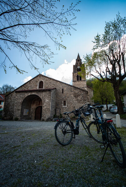
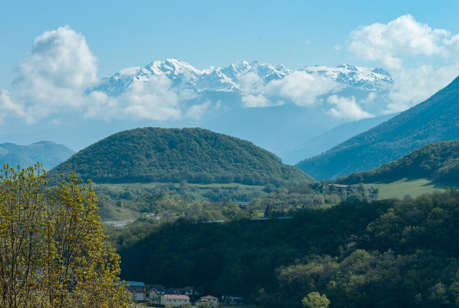
At the start or end of your walk, take a stroll through the center of Vif, where you'll find the historic Hôtel de Ville, Musée Champollion and Saint-Jean-Baptiste church. In the hamlet of Genevrey, linger near the church of Sainte-Marie, whose medieval architecture is enhanced by the painting over the entrance portal. On the way back, let yourself be charmed by the view of the Belledonne mountain range.
From the salle des fêtes parking lot, head up Rue du Polygone, cross the D1075 with care, and then take Rue Gustave Guerre along the Gresse torrent.
Take the cycle lane along Avenue du Général de Gaulle (D8) on your right. At the entrance to Le Genevrey, cross the D8 with care and turn left onto rue de l'Église, level with the cemetery.
Continue on Avenue Louis Vicat, slightly to the right.
At the crossroads, carefully cross back over to the D8 to turn left onto the cycle lane. Then, 100m further on, as you leave the bridge, take rue du 8mai 1945, which runs straight ahead towards place de la Cascade.
Turn right onto rue des Moulins and continue up the hill on route de Champrond, which rises on your right.
Continue downhill to the right on route de Champrond, which becomes route de Champrond à Vif, also known as route des Celliers.
Turn right over the D1075 bridge to reach Vif and your starting point.Equipments : Parking nearby, Admission fee : Free access.Opening : All year round. Subject to favorable weather.
This is a stroll along the water's edge, which you begin by following the torrent of La Gresse on the way out, and which you follow upstream on the other bank on the way back. In between, you'll take the D8, a completely flat but relatively busy road, before moving on to quieter secondary roads with a slightly steeper gradient. It's a family outing with no major difficulties.
At the start or end of your walk, take a stroll through the center of Vif, where you'll find the historic Hôtel de Ville, Musée Champollion and Saint-Jean-Baptiste church. In the hamlet of Genevrey, linger near the church of Sainte-Marie, whose medieval architecture is enhanced by the painting over the entrance portal. On the way back, let yourself be charmed by the view of the Belledonne mountain range.
From the salle des fêtes parking lot, head up Rue du Polygone, cross the D1075 with care, and then take Rue Gustave Guerre along the Gresse torrent.
Take the cycle lane along Avenue du Général de Gaulle (D8) on your right. At the entrance to Le Genevrey, cross the D8 with care and turn left onto rue de l'Église, level with the cemetery.
Continue on Avenue Louis Vicat, slightly to the right.
At the crossroads, carefully cross back over to the D8 to turn left onto the cycle lane. Then, 100m further on, as you leave the bridge, take rue du 8mai 1945, which runs straight ahead towards place de la Cascade.
Turn right onto rue des Moulins and continue up the hill on route de Champrond, which rises on your right.
Continue downhill to the right on route de Champrond, which becomes route de Champrond à Vif, also known as route des Celliers.
Turn right over the D1075 bridge to reach Vif and your starting point.Equipments : Parking nearby, Admission fee : Free access.Opening : All year round. Subject to favorable weather.
Area : Grenoble-Alpes Métropole
Report a problem
Website Pdf file Pdf file Features of the application :
- Location and orientation on detailed maps thanks to the GPS of your smartphone
- Description of routes and points of interest on the route
- Photo gallery by route
- Detailed elevation profile
- Route tracking alert to warn you if you stray from the route
- Send predefined messages by SMS to your contacts
- Emergency module: trigger a call or send an emergency SMS in case of problem
- Agenda: access to events organized in the department
- News: find in the application the latest news on the web portal
- Adding achievements
- Add reports in case of problems encountered on the routes
- Share on social networks
Add your time and share your feelings
Services nearby

Musée Champollion
Vif
Musée Autrefois
Champ-sur-Drac

Auberge des Allières
Lans-en-Vercors
The chemistry Museum
Jarrie

Espace naturel sensible de la tourbière du Peuil
Claix


Information updated on 2024-08-20 by Office de Tourisme Grenoble Alpes


Follow us on
the digital trails
the digital trails


![]()
The Isère Outdoor application was created
by the Département de l'Isère
Infos & contact
Conseil départemental de l'Isère
7 rue Fantin Latour
CS 41096
38 022 Grenoble cedex 1
Tel. 04 76 00 38 38
 Isère Outdoor - Parcours - Boucle vélo Vif - Les Saillants-du-Gua
Hello, world! This is a toast message.
Isère Outdoor - Parcours - Boucle vélo Vif - Les Saillants-du-Gua
Hello, world! This is a toast message.
Isère Outdoor - Parcours - Boucle vélo Vif - Les Saillants-du-Gua
Hello, world! This is a toast message.


OK
Annuler