La Pierre Percée - 9,5 km - Vert
Add to my favorites

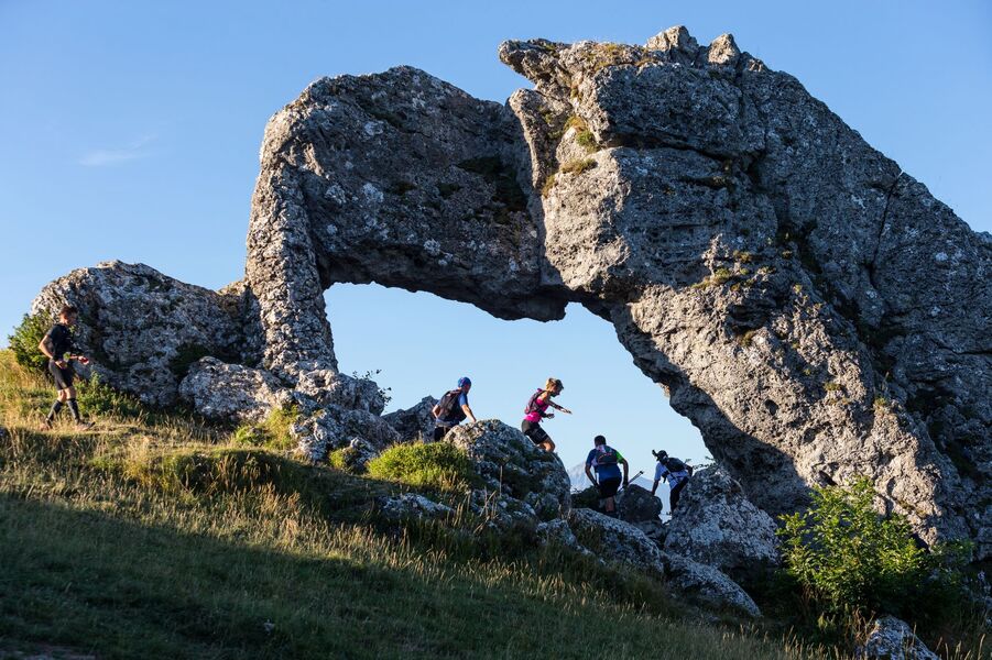
After a fairly easy start, flat, you will go down to the pond of Crey. The ascent of the Pierre Percée is quite long but shaded, and on the exposed final, the walk might be welcome... Easy return downhill.
The characteristics of the route.

La Motte-d'Aveillans (38)
- Distance 9.59 km
- Elevation gain 384 m
- Elevation lost 384 m
- Min. elevation 892 m
- Max. elevation. 1243 m
- Marking Yes
This on-track course will make you discover one of the wonders of the Dauphiné. The easy start will take you to the Crey pond.
After crossing the bocage, the ascent to the Pierre Percée will begin, shaded but long. The walk may be necessary on the last part, which is very exposed...
After a pause-contemplation at the foot of the Stone, the pleasant descent will bring you back to the start.Admission fee : Free access.Opening : All year round daily. Subject to favorable snow and weather conditions.
After crossing the bocage, the ascent to the Pierre Percée will begin, shaded but long. The walk may be necessary on the last part, which is very exposed...
After a pause-contemplation at the foot of the Stone, the pleasant descent will bring you back to the start.Admission fee : Free access.Opening : All year round daily. Subject to favorable snow and weather conditions.
Area : Matheysine
Report a problem
Website Pdf file Features of the application :
- Location and orientation on detailed maps thanks to the GPS of your smartphone
- Description of routes and points of interest on the route
- Photo gallery by route
- Detailed elevation profile
- Route tracking alert to warn you if you stray from the route
- Send predefined messages by SMS to your contacts
- Emergency module: trigger a call or send an emergency SMS in case of problem
- Agenda: access to events organized in the department
- News: find in the application the latest news on the web portal
- Adding achievements
- Add reports in case of problems encountered on the routes
- Share on social networks
Add your time and share your feelings
Services nearby

La Mine Image
La Motte-d'Aveillans

Tourist office of La Motte d'Aveillans
La Motte-d'Aveillans

Belvédère Olivier Messiaen
Saint-Théoffrey
Musée Matheysin
La Mure
Atelier Gilioli
Saint-Martin-de-la-Cluze


Information updated on 2026-05-29 by Matheysine Tourisme


Follow us on
the digital trails
the digital trails





The Isère Outdoor application was created
by the Département de l'Isère
Infos & contact
Conseil départemental de l'Isère
7 rue Fantin Latour
CS 41096
38 022 Grenoble cedex 1
Tel. 04 76 00 38 38
 Isère Outdoor - Parcours - La Pierre Percée - 9,5 km - Vert
Hello, world! This is a toast message.
Isère Outdoor - Parcours - La Pierre Percée - 9,5 km - Vert
Hello, world! This is a toast message.
Isère Outdoor - Parcours - La Pierre Percée - 9,5 km - Vert
Hello, world! This is a toast message.


OK
Annuler