Bièvre Isère - La Combe d'Agnières
Add to my favorites

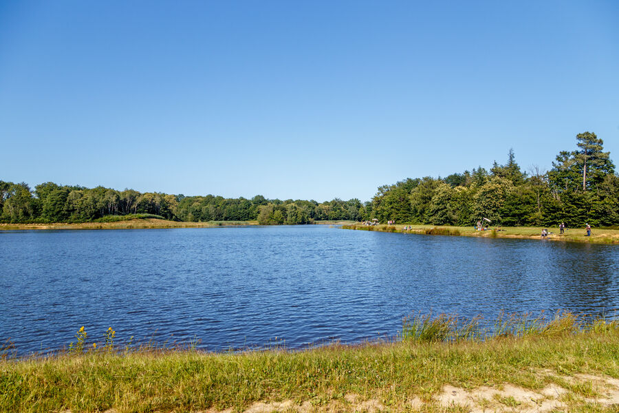
Un parcours simple mais efficace à travers la forêt de Bonnevaux. Une seule difficulté en fin de circuit après la combe d’agnières, nous vous suggérons de partir « piano ».
The characteristics of the route.
Bossieu (38)
- Distance 9.2 km
- Elevation gain 140 m
- Elevation lost 140 m
- Min. elevation 421 m
- Max. elevation. 521 m
- Marking Yes
Equipments : Picnic area, Admission fee : Free access.Opening : All year round.
Area : Bièvre Isère
Report a problem
Website Pdf file Features of the application :
- Location and orientation on detailed maps thanks to the GPS of your smartphone
- Description of routes and points of interest on the route
- Photo gallery by route
- Detailed elevation profile
- Route tracking alert to warn you if you stray from the route
- Send predefined messages by SMS to your contacts
- Emergency module: trigger a call or send an emergency SMS in case of problem
- Agenda: access to events organized in the department
- News: find in the application the latest news on the web portal
- Adding achievements
- Add reports in case of problems encountered on the routes
- Share on social networks
rome1
The 2022/12/30
En savoir plus
Ajouter votre chrono et partager vos sensations
2022/12/30 rome1
Parcours trés sympa ; manque juste du balisage 700m apres le départ et pb de balissage au km 5 dommage
2022/12/30 rome1
Parcours trés sympa ; manque juste du balisage 700m apres le départ et pb de balissage au km 5 dommage
Services nearby

Espace naturel sensible de l'étang de Montjoux
Saint-Jean-de-Bournay
Espace naturel sensible Les fontaines de Beaufort
Beaufort

Hector berlioz Museum
La Côte-Saint-André

La Côte-Saint-André Tourist information center
La Côte-Saint-André
Musée des Liqueurs Cherry-Rocher
La Côte-Saint-André


Information updated on 2021-10-08 by Office de Tourisme Terres de Berlioz


Follow us on
the digital trails
the digital trails


![]()
The Isère Outdoor application was created
by the Département de l'Isère
Infos & contact
Conseil départemental de l'Isère
7 rue Fantin Latour
CS 41096
38 022 Grenoble cedex 1
Tel. 04 76 00 38 38
 Isère Outdoor - Parcours - Bièvre Isère - La Combe d'Agnières
Hello, world! This is a toast message.
Isère Outdoor - Parcours - Bièvre Isère - La Combe d'Agnières
Hello, world! This is a toast message.
Isère Outdoor - Parcours - Bièvre Isère - La Combe d'Agnières
Hello, world! This is a toast message.


OK
Annuler