Crossing of Mont Jalla
Add to my favorites

Caution! Zone of vigilance near the route
Circaète Jean-le-Blanc - du 01/03/2026 au 30/09/2026 In progress
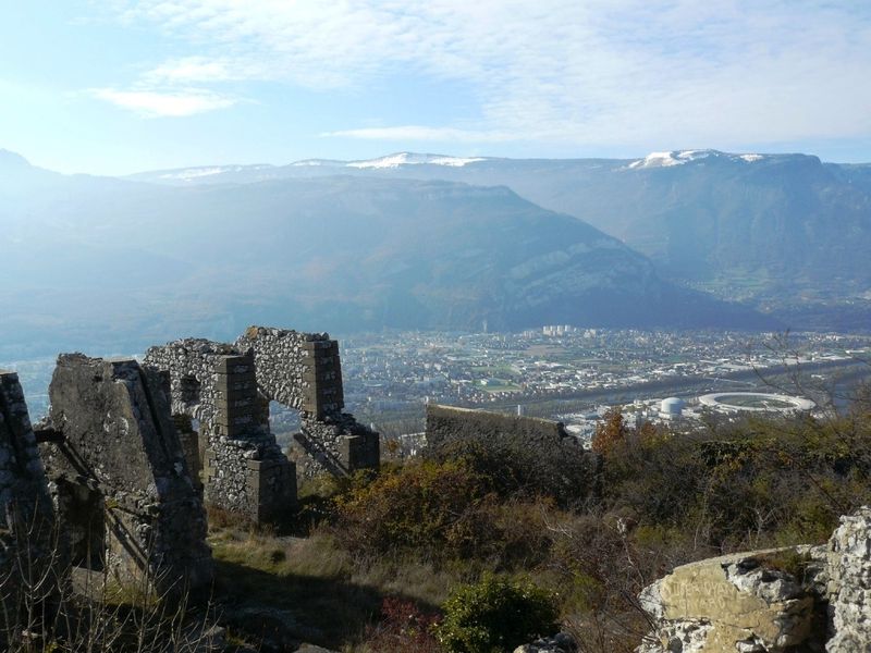
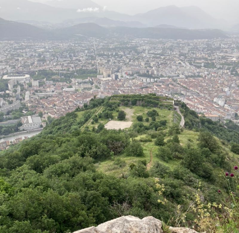
A unique view of the Grenoble area from Mount Jalla and the memorial of the mountain troops.
Route labeled FFRandonnée

The characteristics of the route.

Grenoble (38)
- Distance 8.6 km
- Elevation gain 520 m
- Elevation lost 520 m
- Min. elevation 212 m
- Max. elevation. 634 m
- Duration (depending on pace) 3h
- Marking Yes
Marking : Yellow markings (PR)Equipments : Car park, Admission fee : Free access.Opening : All year round.
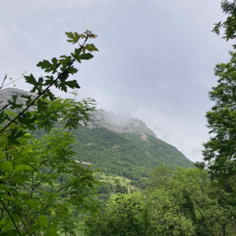
Subject to favorable weather.Step by step description : 1. From the entrance to the Jardin des Dauphins (please note garden opening times: 9 a.m.-8 p.m. in summer and 9 a.m.-6 p.m. in winter), climb up to the Bastille (sentier de la Mémoire et de la Paix) via the garden paths. From the Guy-Pape garden, the itinerary is a succession of paths, staircases and passages through the fortifications.
2. From the dungeon courtyard (below the cable car entrance), exit through the postern and turn right onto the trail towards Mont Jalla (junction with GR® 9) (caves known as the Mandrin caves). Before the Père Gras inn, turn left onto the fire-fighting track that climbs to the summit of Mont Jalla (630 m). Reach the crest (post "La Chenaie").
3. Leave the GR® 9 and head left towards the memorial, as far as the "Mont Jalla" post (national memorial to mountain troops). Turn right onto a steep path, descending rapidly to Mas Gachet. Descend by the road for about 300 m (view of the Aiguille de Quaix).
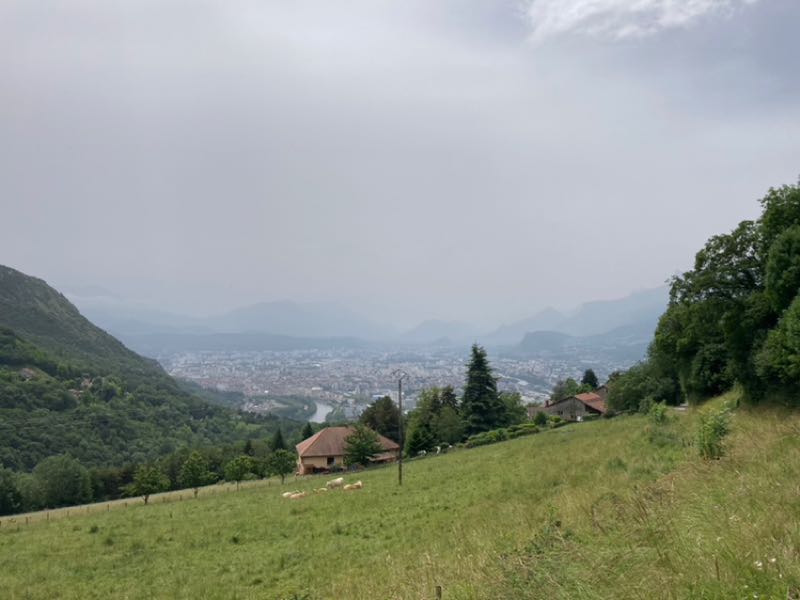
4. Turn left along a housing estate. At Gomma, cross the D57 to go straight ahead on a wide, undulating path through undergrowth. Cross two small bridges and climb up to Gatinet. Take the small road to the left, round the Château de Narbonne and continue downhill for about 150 m.
5. Along a hedge, take a path on the left (sunken road, steep descent) to Le Canet. Cross the road and descend to Pique Pierre via Place des Compagnons Charpentiers, Chemin de la
Cheminée and route de Narbonne 6
You can walk back to the Esplanade along the cycle path that runs alongside the Isère river.
Area : Grenoble-Alpes Métropole
Report a problem
Website Pdf file Features of the application :
- Location and orientation on detailed maps thanks to the GPS of your smartphone
- Description of routes and points of interest on the route
- Photo gallery by route
- Detailed elevation profile
- Route tracking alert to warn you if you stray from the route
- Send predefined messages by SMS to your contacts
- Emergency module: trigger a call or send an emergency SMS in case of problem
- Agenda: access to events organized in the department
- News: find in the application the latest news on the web portal
- Adding achievements
- Add reports in case of problems encountered on the routes
- Share on social networks
meunomeecris
finished in 04:00:00
The 2024/06/09
En savoir plus
meunomeecris
The 2024/06/09
En savoir plus
Ajouter votre chrono et partager vos sensations
2024/06/09 meunomeecris
Très bon l'itinéraire, avec une belle vue. Il y a un peu de descente et de montée, mais elles ne sont pas difficiles.
Services nearby

Mountain Troops Museum
Grenoble

Bastille Tourist Information Center
Grenoble
The dauphinois museum
Grenoble
Arhome, Museum of the industrial innovation
Grenoble
Saint-Laurent Archaeological Museum, Grenoble
Grenoble


Information updated on 2025-05-06 by Office de Tourisme Grenoble Alpes


Follow us on
the digital trails
the digital trails


![]()
The Isère Outdoor application was created
by the Département de l'Isère
Infos & contact
Conseil départemental de l'Isère
7 rue Fantin Latour
CS 41096
38 022 Grenoble cedex 1
Tel. 04 76 00 38 38
 Isère Outdoor - Parcours - Crossing of Mont Jalla
Hello, world! This is a toast message.
Isère Outdoor - Parcours - Crossing of Mont Jalla
Hello, world! This is a toast message.
Isère Outdoor - Parcours - Crossing of Mont Jalla
Hello, world! This is a toast message.


OK
Annuler