From the foothills of the Vercors to those of the Dévoluy - Cycling path n°9
Add to my favorites

Caution! Zone of vigilance near the route
Aigle royal - du 01/01/2026 au 31/08/2026 In progress
Aigle royal - du 01/01/2026 au 31/08/2026 In progress
Aigle royal - du 01/01/2026 au 31/08/2026 In progress
Grand-duc d'Europe - du 01/01/2026 au 31/08/2026 In progress
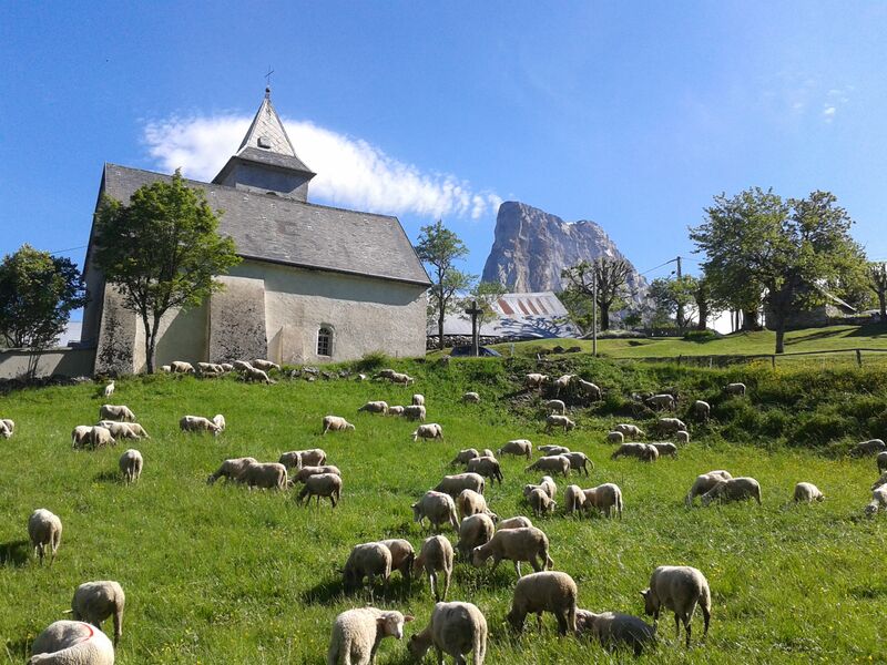
A magnificent itinerary that allows you to appreciate the rich landscapes of the Trièves, from the foothills of the Vercors massif to those of the Dévoluy massif! The program includes passes, picturesque villages, small undulating roads, panoramic views...
The characteristics of the route.

Mens (38)
- Distance 100.8 km
- Elevation gain 2160 m
- Elevation lost 2160 m
- Min. elevation 484 m
- Max. elevation. 1352 m
- Duration (depending on pace) 4h15
- Marking No
Equipments : Parking nearby, Good plans : You'll find everything you need for minor repairs at every Tourist Office branch.Delicate passages : If you're travelling on the RD1075, which carries heavy traffic for 10 km between Saint-Michel-Les-Portes and Longefonds, be on your guard!Admission fee : Free access.Opening : All year round.
Subject to favorable weather.
Area : Trièves
Report a problem
Website Pdf file Pdf file Features of the application :
- Location and orientation on detailed maps thanks to the GPS of your smartphone
- Description of routes and points of interest on the route
- Photo gallery by route
- Detailed elevation profile
- Route tracking alert to warn you if you stray from the route
- Send predefined messages by SMS to your contacts
- Emergency module: trigger a call or send an emergency SMS in case of problem
- Agenda: access to events organized in the department
- News: find in the application the latest news on the web portal
- Adding achievements
- Add reports in case of problems encountered on the routes
- Share on social networks
Add your time and share your feelings
Services nearby

Musée du Trièves
Mens

Bureau d'Informations Touristiques de Mens - Office de Tourisme du Trièves
Mens
Point d'information Tréminis
Tréminis

Foyer nordique de Tréminis
Tréminis
Espace Giono
Lalley


Information updated on 2024-12-19 by Office de Tourisme du Trièves


Follow us on
the digital trails
the digital trails


![]()
The Isère Outdoor application was created
by the Département de l'Isère
Infos & contact
Conseil départemental de l'Isère
7 rue Fantin Latour
CS 41096
38 022 Grenoble cedex 1
Tel. 04 76 00 38 38
 Isère Outdoor - Parcours - From the foothills of the Vercors to those of the Dévoluy - Cycling path n°9
Hello, world! This is a toast message.
Isère Outdoor - Parcours - From the foothills of the Vercors to those of the Dévoluy - Cycling path n°9
Hello, world! This is a toast message.
Isère Outdoor - Parcours - From the foothills of the Vercors to those of the Dévoluy - Cycling path n°9
Hello, world! This is a toast message.


OK
Annuler