La Boucle des 3 Châteaux
Add to my favorites

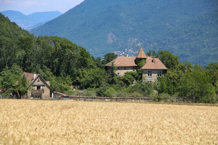
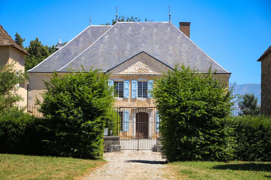
Discover 3 castles: Château d'Avignonet (17th century), Château de Pâquier (16th century) and the ruins of Château d'Ars (13th century). Enjoy panoramic views over the Drac valley and the Monteynard-Avignonet dam.
Route labeled FFRandonnée

The characteristics of the route.

Avignonet (38)
- Distance 14.6 km
- Elevation gain 540 m
- Elevation lost 540 m
- Min. elevation 368 m
- Max. elevation. 821 m
- Duration (depending on pace) 6h
- Marking Yes
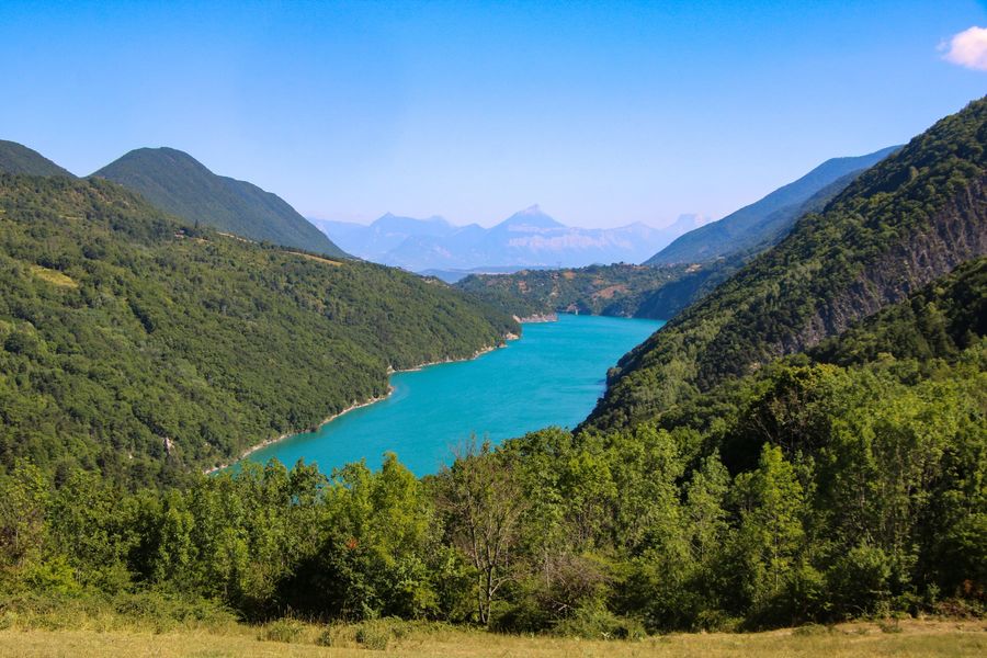
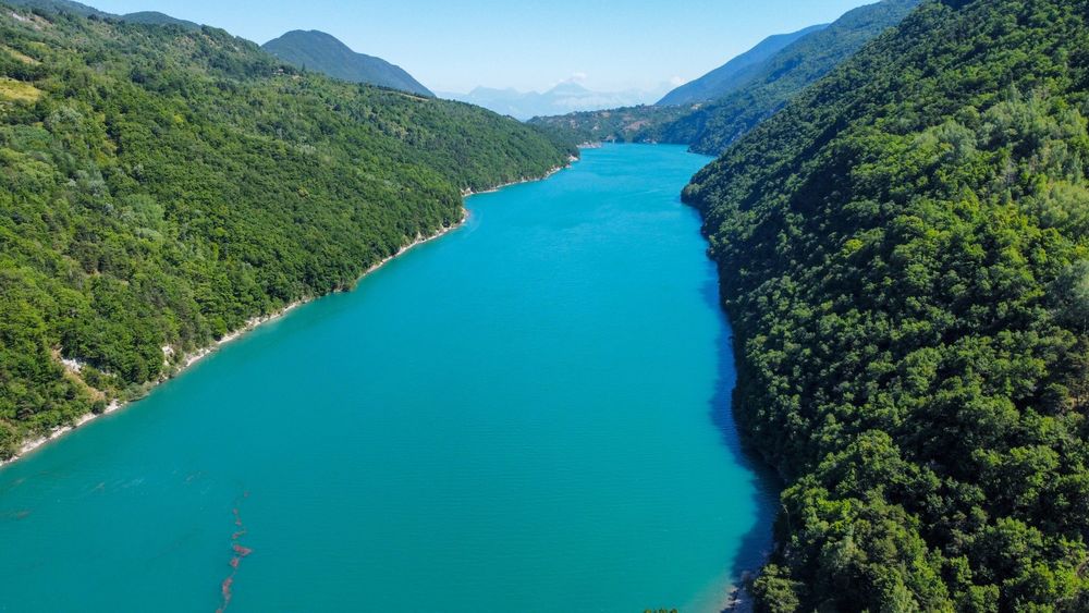
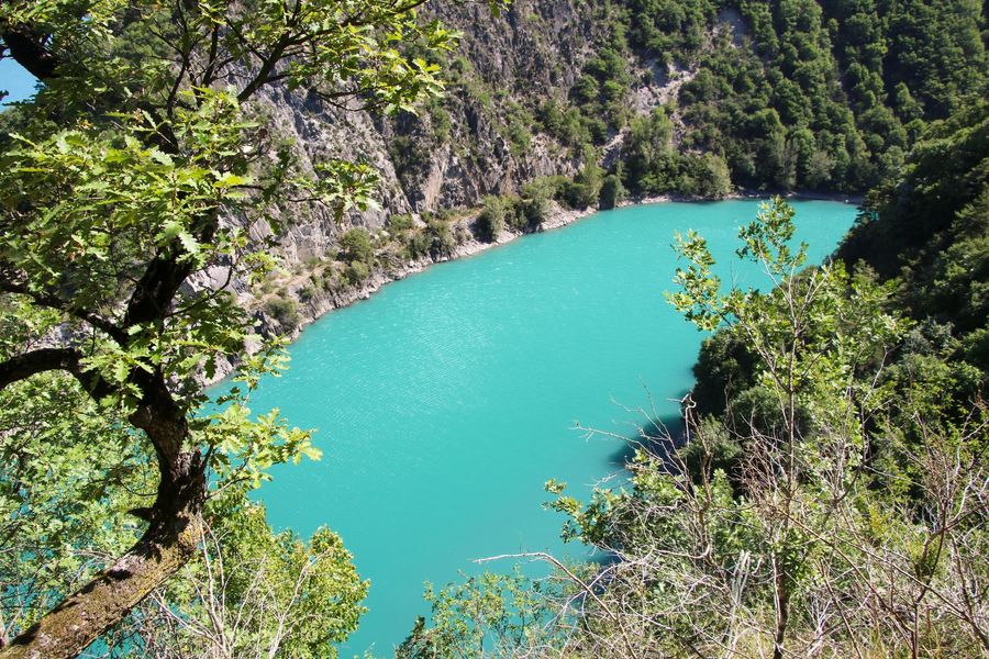
Take the start of a historic hike! This beautiful loop will take you to a wild lake: Notre Dame de Commiers, where swimming and water sports are prohibited. You'll also discover a host of charming little hamlets.Equipments : Car park, Admission fee : Free access.Opening : All year round daily.
Subject to favorable weather.Step by step description : Start: Park in the Avignonet Mairie parking lot.
Follow the yellow signpost to "Avignonet Mairie".
1) From this sign, take the tarmac road towards "La Croix de Molignère". This long track crosses fields and then turns into a gravel path. After passing a farm, you'll come to a path in a wood. This descends to the "La Croix de Molignère" post. From this post, follow the signs for "Château d'Ars" on the left. Follow the tarmac road to the small hamlet of Molignière, then take the path down to the right beside the building. The path descends to the "Cattiers" post.
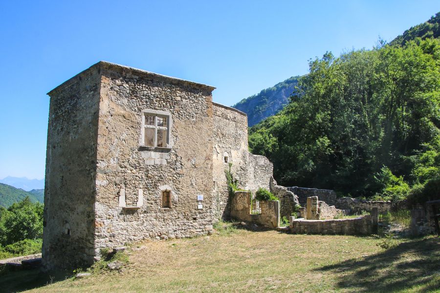
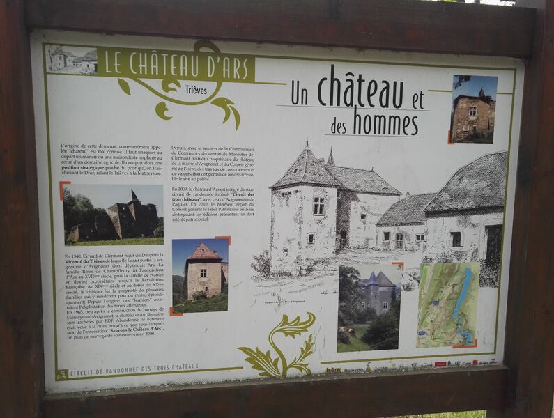
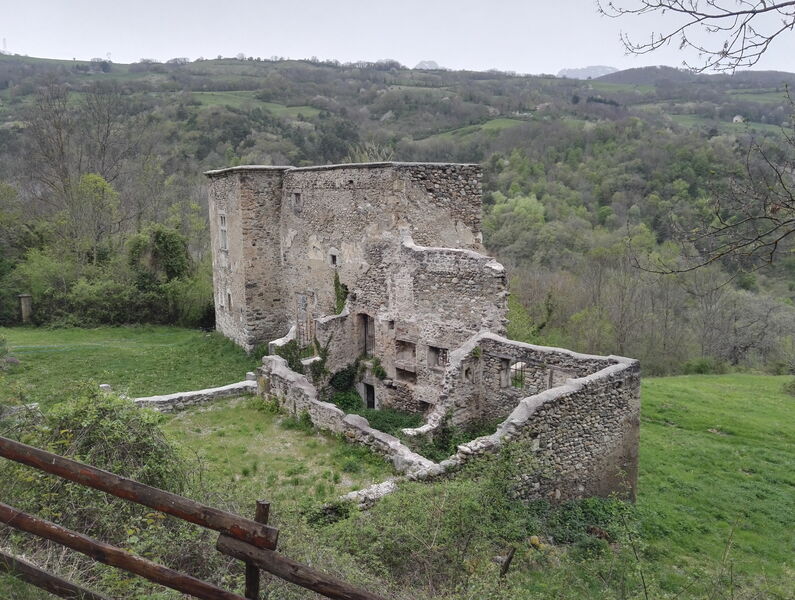
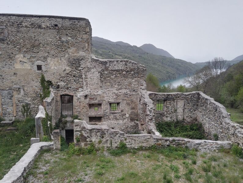
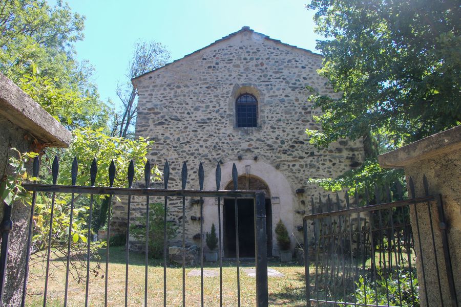
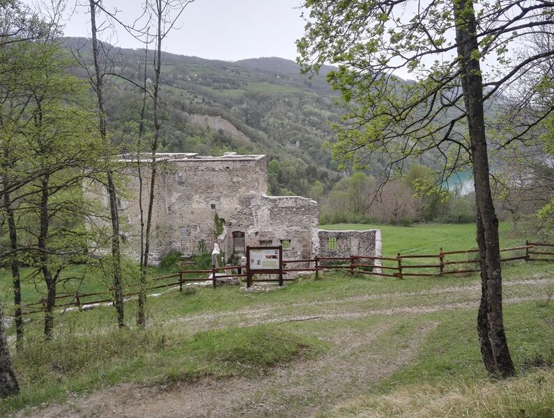
2) From the "Les Cattiers" post, follow the signs for "Château d'Ars" once again. You'll come to the hamlet, but make sure you turn right before the buildings. A gravel track leads downhill, offering fine views of the Monteynard-Avignonet dam. Follow the track to the left as you enter the cow park, then descend through a succession of bends to the "Château d'Ars", a partially restored ancient castle. Take advantage of this stop to recharge your batteries and learn more about the area.
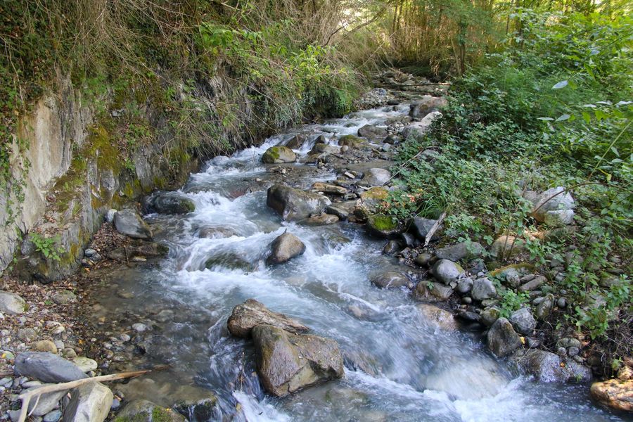
3) From the "Château d'Ars" post, head for "Mageline". To do this, you'll need to take the small path leading off into the forest. This path descends until it offers magnificent views of the lake at Notre Dame de Commiers. The descent continues until you come to a stream that flows into the lake. Once you've crossed this stream, you begin the complex part of the hike. This involves a relatively steep climb through the forest to a new park. The climb continues until you reach the hamlet of "Mageline".
4) From the "Mageline" sign, follow the signs for "La Croix des Chevaliers", taking the asphalt road which climbs steadily.
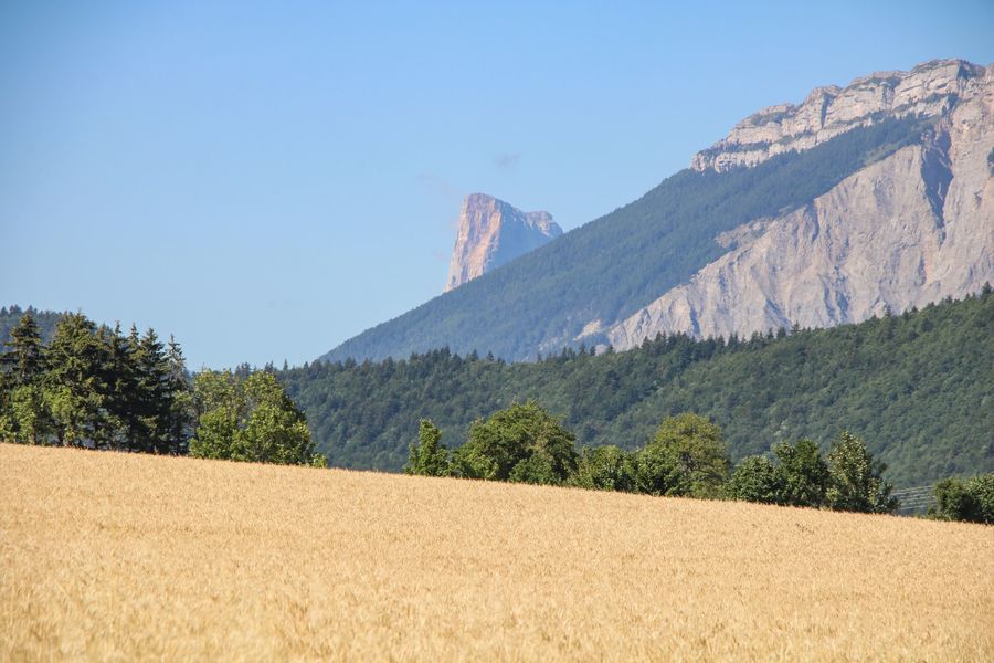
5) From "La Croix des Chevaliers", follow the signs for "Pâquier". Take the path through the fields, offering lovely views of the surrounding mountains. This track takes you to the hamlet of "Pâquier", where you can discover the magnificent chapel, then head off in the direction of "St Martin de la Cluze". This time you'll pass through the hamlet of "Pâquier", where you'll find the next post.
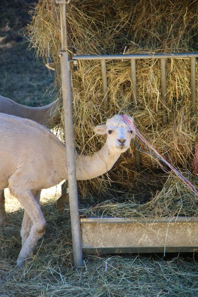
6) From "Pâquier", head towards "Peillavène" as you climb through the hamlet, then head towards "Château de Pâquier". You'll soon reach the château, where you'll find a stud farm and an alpaca farm. At the "Château de Pâquier" signpost, head for "St Martin la Cluze", taking the track to the right across the fields. Once in the village of "St Martin la Cluze", turn left after the school to reach "Les 5 chemins".
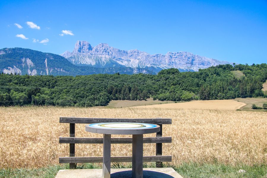
7) From "Les 5 chemins", turn right towards Avignonet. First take a road, then a track through the fields. This long track takes you to an orientation table. Enjoy the view, then continue to the "Les Plaines" sign, where you go straight on past the Château d'Avignonet. You'll soon reach the town hall, your starting point.
Area : Trièves
Report a problem
Website Pdf file Features of the application :
- Location and orientation on detailed maps thanks to the GPS of your smartphone
- Description of routes and points of interest on the route
- Photo gallery by route
- Detailed elevation profile
- Route tracking alert to warn you if you stray from the route
- Send predefined messages by SMS to your contacts
- Emergency module: trigger a call or send an emergency SMS in case of problem
- Agenda: access to events organized in the department
- News: find in the application the latest news on the web portal
- Adding achievements
- Add reports in case of problems encountered on the routes
- Share on social networks
Add your time and share your feelings
Services nearby

Atelier Gilioli
Saint-Martin-de-la-Cluze

Point d'information du Môle (Lac de Monteynard-Avignonet)
Treffort
Maison du Tourisme de La Motte d'Aveillans
La Motte-d'Aveillans
Musuem "La Mine Image"
La Motte-d'Aveillans

Refuge La Soldanelle
Château-Bernard


Information updated on 2025-12-18 by Isère Attractivité


Follow us on
the digital trails
the digital trails


![]()
The Isère Outdoor application was created
by the Département de l'Isère
Infos & contact
Conseil départemental de l'Isère
7 rue Fantin Latour
CS 41096
38 022 Grenoble cedex 1
Tel. 04 76 00 38 38
 Isère Outdoor - Parcours - La Boucle des 3 Châteaux
Hello, world! This is a toast message.
Isère Outdoor - Parcours - La Boucle des 3 Châteaux
Hello, world! This is a toast message.
Isère Outdoor - Parcours - La Boucle des 3 Châteaux
Hello, world! This is a toast message.


OK
Annuler