Le Châtel (ou Bonnet de Calvin)
Add to my favorites

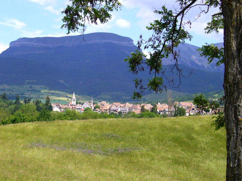
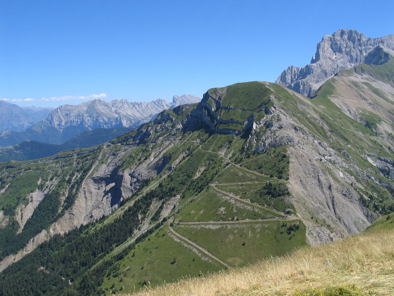
This round-trip itinerary offers incomparable panoramic views of the Trièves and surrounding mountains: the Vercors, Obiou and Écrins.
Route labeled FFRandonnée

The characteristics of the route.

Mens (38)
- Distance 9.2 km
- Elevation gain 720 m
- Elevation lost 720 m
- Min. elevation 1274 m
- Max. elevation. 1935 m
- Duration (depending on pace) 4h30
- Marking Yes
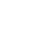
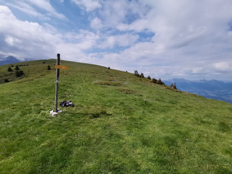
Marking : Yellow signs (PR)Equipments : Car park, Delicate passages : The balcony path above the cliffs, after the Col de la Brèche to the guards' hut, requires particular attention. Even if this path is wide enough, there is a risk of falling for around 300m, on ground that can be slippery after bad weather. The round-trip option is therefore more suitable for families.Admission fee : Free access.Opening : From 01/05 to 31/10.
Subject to favorable weather.Step by step description : 1. From the parking lot ("Baret" post, 1280 m), take the forest path towards Le Châtel (-> also called Bonnet de Calvin because of its characteristic shape). Cross the fir grove to join a forest track in a bend at the "Granges de Châtel" posts (1,390 m).
2. A few metres further on, take the path on the left, which climbs steadily. Rejoin the forest track and continue to its terminal platform. The trail continues with a few steep staircase sections and reaches the ridge at the "Le Châtel" post (1,890 m).
3. Reach the summit of Bonnet de Calvin to the right along a path through the meadow. It is marked by a milestone (1,937 m).
4. Go back down to the crossroads (point 3) and continue on to the orientation table.
5. Return by the same route as the outward journey.
Area : Trièves
Report a problem
Website Pdf file Features of the application :
- Location and orientation on detailed maps thanks to the GPS of your smartphone
- Description of routes and points of interest on the route
- Photo gallery by route
- Detailed elevation profile
- Route tracking alert to warn you if you stray from the route
- Send predefined messages by SMS to your contacts
- Emergency module: trigger a call or send an emergency SMS in case of problem
- Agenda: access to events organized in the department
- News: find in the application the latest news on the web portal
- Adding achievements
- Add reports in case of problems encountered on the routes
- Share on social networks
Add your time and share your feelings
Services nearby

Bureau d'Informations Touristiques de Mens - Office de Tourisme du Trièves
Mens

Musée du Trièves
Mens
Foyer nordique de Tréminis
Tréminis
Point d'information Tréminis
Tréminis
Museum "Musée Matheysin"
La Mure


Information updated on 2025-12-18 by Isère Attractivité


Follow us on
the digital trails
the digital trails


![]()
The Isère Outdoor application was created
by the Département de l'Isère
Infos & contact
Conseil départemental de l'Isère
7 rue Fantin Latour
CS 41096
38 022 Grenoble cedex 1
Tel. 04 76 00 38 38
 Isère Outdoor - Parcours - Le Châtel (ou Bonnet de Calvin)
Hello, world! This is a toast message.
Isère Outdoor - Parcours - Le Châtel (ou Bonnet de Calvin)
Hello, world! This is a toast message.
Isère Outdoor - Parcours - Le Châtel (ou Bonnet de Calvin)
Hello, world! This is a toast message.


OK
Annuler