Combe Lambert
Add to my favorites

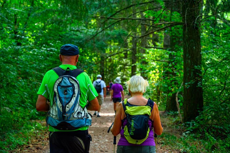
Explore the many hamlets that line Combe Lambert, winding your way through forests and meadows.
Route labeled FFRandonnée

The characteristics of the route.

Montrevel (38)
- Distance 12 km
- Elevation gain 340 m
- Elevation lost 340 m
- Min. elevation 499 m
- Max. elevation. 687 m
- Duration (depending on pace) 3h30
- Marking Yes
From Montrevel, walk up alongside the church and onto the gravel path. Go past the farm buildings and turn right after the meadows onto the path. It joins a track that you need to take uphill. Just before the forest, turn right onto the track leading to "La Touqueta".
Continue straight ahead until you reach the hamlet. Cross the hamlet to the left and join the Chemin de Combe Lambert. Continue uphill as far as "Vaux".
Take the steep section of road on the left, which soon gives way to an undulating track. Cross between the houses to reach "Les Serves", then continue straight ahead on the track. At the crossroads on the way down, turn right on a rising level. The path leaves the meadows and continues through the forest to reach "Bois du Seigneur".
Turn left, following the path downhill to "Les Taillis". Continue right along the track past a pond to the Bois Vert. From here, turn left and stay on the road at the next crossroads. Come to a right-angle bend where there is an old tree and continue straight ahead on the track. This joins "La Touqueta" further on. The return journey takes the same route.
Throughout the route, follow the yellow markings and the following junctions: MONTREVEL > La Touqueta > Chemin de combe Lambert > Vaux > Bois du Seigneur > Taillis > Bois vert > La Touqueta > MONTREVEL
Translated with DeepL.com (free version)Marking : Follow the yellow signs. Follow the following crossroads: MONTREVEL > La Touqueta > Chemin de combe Lambert > Vaux > Bois du Seigneur > Taillis > Bois vert > La Touqueta > MONTREVELEquipments : Car park, Admission fee : Free access.Opening : All year round.
Area : Vals du Dauphiné
Report a problem
Website Pdf file Features of the application :
- Location and orientation on detailed maps thanks to the GPS of your smartphone
- Description of routes and points of interest on the route
- Photo gallery by route
- Detailed elevation profile
- Route tracking alert to warn you if you stray from the route
- Send predefined messages by SMS to your contacts
- Emergency module: trigger a call or send an emergency SMS in case of problem
- Agenda: access to events organized in the department
- News: find in the application the latest news on the web portal
- Adding achievements
- Add reports in case of problems encountered on the routes
- Share on social networks
Gal38110
The 2024/07/31
En savoir plus
Ajouter votre chrono et partager vos sensations
2024/07/31 Gal38110
Très bonne rando, à faire l'été car en forêt quasi tout le long (90% du temps) et probablement encore plus belle à l'automne pour la vue panoramique avec les différentes couleurs des arbres
2024/07/31 Gal38110
Très bonne rando, à faire l'été car en forêt quasi tout le long (90% du temps) et probablement encore plus belle à l'automne pour la vue panoramique avec les différentes couleurs des arbres
Services nearby

Relais Cyné de Châbons
Châbons
Relais Cyné de Chateauvilain
Châteauvilain

Clog museum
Val-de-Virieu
Ecomusée rural
Longechenal
Relais Cyné de Colombe
Colombe


Information updated on 2024-07-19 by Isère Attractivité


Follow us on
the digital trails
the digital trails


![]()
The Isère Outdoor application was created
by the Département de l'Isère
Infos & contact
Conseil départemental de l'Isère
7 rue Fantin Latour
CS 41096
38 022 Grenoble cedex 1
Tel. 04 76 00 38 38
 Isère Outdoor - Parcours - Combe Lambert
Hello, world! This is a toast message.
Isère Outdoor - Parcours - Combe Lambert
Hello, world! This is a toast message.
Isère Outdoor - Parcours - Combe Lambert
Hello, world! This is a toast message.


OK
Annuler