Car-free hike 2 days / 1 night- Les lacs de la Muzelle et du Lauvitel
Add to my favorites

Caution! Zone of vigilance near the route
Route closed
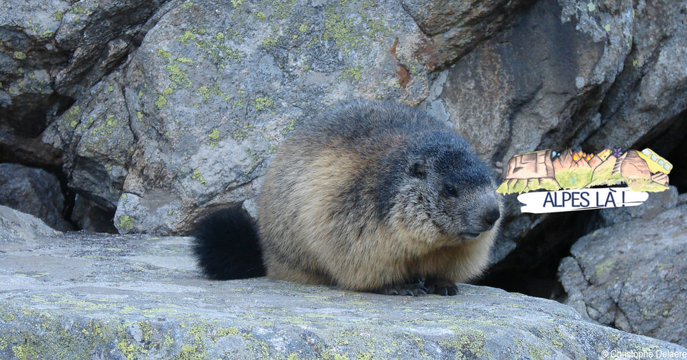
Discover two magnificent lakes and a complete nature reserve that is closely studied by scientists.
Overnight stay at the Muzelle refuge (reservation essential).
Itinerary with public transport proposed by Alpes Là.
The characteristics of the route.

Les Deux Alpes (38)
- Distance 17.7 km
- Elevation gain 1690 m
- Elevation lost 1780 m
- Min. elevation 832 m
- Max. elevation. 2529 m
- Duration (depending on pace) 4h30
- Marking Yes
Please note: this site is located in the heart of a French National Park and is subject to specific regulations. This is an exceptional area, and as such is subject to specific regulations. We invite you to adopt the right reflexes when you come to protect these treasures.
Start: Bourg d'Arud Camping (954 m) - 1 h 10 (2 km, D+ 321 m, D- 12 m)
From the stop, cross Bourg d'Arud on the D530 (heading south-east). Cross the bridge over the Vénéon and turn right through the hamlet of l'Alleau and its fountain-washhouse. Then follow the GR54® path rapidly rising through the forest to reach a characteristic ruin.
1) Ruine du Pleynet (1249 m) - 3 h (4.4 km, D+ 900 m, D- 30 m)
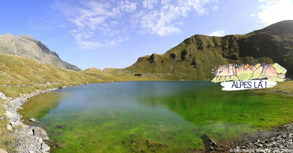
Follow the path along the torrent de la Pisse, with its beautiful waterfalls. At the Chapeau Roux waterfall, the path crosses the torrent via a footbridge, then continues up steep switchbacks to reach a peat bog flat. Five hundred metres further on, you come to the refuge and Lac de la Muzelle in its glacial cirque, where tongues of the hanging glacier
glacier.
2) Refuge de la Muzelle (2130 m) - 1 h 30 (2.4 km, D+ 413 m)
Follow the path along the edge of the lake until you cross a footbridge (2102 m). Turn due west for the route to the Col du Vallon, which winds its way among rocks (cairns) and then winds its way up a steep, more open slope.
3) Col du Vallon (2531 m) - 1 h 45 (4.3 km, D+ 37 m, D- 1,058 m)
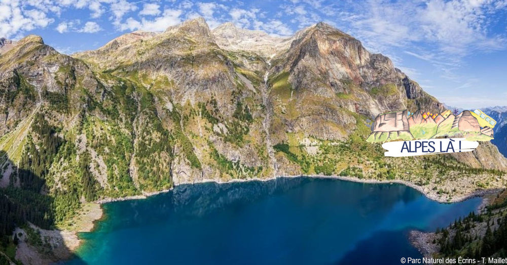
Descend the pass on the north-west side along the path. At around 1750 m, the path bends northwards to cross a ravine (a tricky passage on a rocky slab). After a brief ascent, we descend a few hairpin bends to reach the north shore of Lac Lauvitel. To the south of the lake, an integral nature reserve forbids the presence of man.
4) Lac du Lauvitel - Les Selles (1501m) - 50 min (2.4 km, D- 484 m)
Descend to the Pont des Balmes on the north path, towards La Danchère via Les Selles, along a beautiful paved path and remarkably well-maintained low walls.Marking : This route is marked with yellow signs and yellow paint (PR) and red and white paint (GR).Delicate passages : Access to the Réserve Intégrale du Lauvitel, close to the route, is forbidden. Swimming is not possible in Lac du Lauvitel.Admission fee : Plan the cost of the trip by Bus Cars Région.Opening : From 27/05 to 30/09.Warning : A car-free hike where you can take the bus to and from the site. Make sure you know the time and day of traffic before you leave. Please make arrangements for overnight bivouacs.
Start: Bourg d'Arud Camping (954 m) - 1 h 10 (2 km, D+ 321 m, D- 12 m)
From the stop, cross Bourg d'Arud on the D530 (heading south-east). Cross the bridge over the Vénéon and turn right through the hamlet of l'Alleau and its fountain-washhouse. Then follow the GR54® path rapidly rising through the forest to reach a characteristic ruin.
1) Ruine du Pleynet (1249 m) - 3 h (4.4 km, D+ 900 m, D- 30 m)
Follow the path along the torrent de la Pisse, with its beautiful waterfalls. At the Chapeau Roux waterfall, the path crosses the torrent via a footbridge, then continues up steep switchbacks to reach a peat bog flat. Five hundred metres further on, you come to the refuge and Lac de la Muzelle in its glacial cirque, where tongues of the hanging glacier
glacier.
2) Refuge de la Muzelle (2130 m) - 1 h 30 (2.4 km, D+ 413 m)
Follow the path along the edge of the lake until you cross a footbridge (2102 m). Turn due west for the route to the Col du Vallon, which winds its way among rocks (cairns) and then winds its way up a steep, more open slope.
3) Col du Vallon (2531 m) - 1 h 45 (4.3 km, D+ 37 m, D- 1,058 m)
Descend the pass on the north-west side along the path. At around 1750 m, the path bends northwards to cross a ravine (a tricky passage on a rocky slab). After a brief ascent, we descend a few hairpin bends to reach the north shore of Lac Lauvitel. To the south of the lake, an integral nature reserve forbids the presence of man.
4) Lac du Lauvitel - Les Selles (1501m) - 50 min (2.4 km, D- 484 m)
Descend to the Pont des Balmes on the north path, towards La Danchère via Les Selles, along a beautiful paved path and remarkably well-maintained low walls.Marking : This route is marked with yellow signs and yellow paint (PR) and red and white paint (GR).Delicate passages : Access to the Réserve Intégrale du Lauvitel, close to the route, is forbidden. Swimming is not possible in Lac du Lauvitel.Admission fee : Plan the cost of the trip by Bus Cars Région.Opening : From 27/05 to 30/09.Warning : A car-free hike where you can take the bus to and from the site. Make sure you know the time and day of traffic before you leave. Please make arrangements for overnight bivouacs.
Area : Oisans
Report a problem
Pdf file Pdf file Features of the application :
- Location and orientation on detailed maps thanks to the GPS of your smartphone
- Description of routes and points of interest on the route
- Photo gallery by route
- Detailed elevation profile
- Route tracking alert to warn you if you stray from the route
- Send predefined messages by SMS to your contacts
- Emergency module: trigger a call or send an emergency SMS in case of problem
- Agenda: access to events organized in the department
- News: find in the application the latest news on the web portal
- Adding achievements
- Add reports in case of problems encountered on the routes
- Share on social networks
Add your time and share your feelings
Services nearby

Venosc Tourist Office - Les 2 Alpes
Venosc
2 ALPES TOURIST OFFICE
Les Deux Alpes

Exhibition area - Maison de la Montagne
Les Deux Alpes

La Muzelle Hut
Venosc
Museum " mountaineering Memory"
Saint-Christophe-en-Oisans



Follow us on
the digital trails
the digital trails





The Isère Outdoor application was created
by the Département de l'Isère
Infos & contact
Conseil départemental de l'Isère
7 rue Fantin Latour
CS 41096
38 022 Grenoble cedex 1
Tel. 04 76 00 38 38
 Isère Outdoor - Parcours - Car-free hike 2 days / 1 night- Les lacs de la Muzelle et du Lauvitel
Hello, world! This is a toast message.
Isère Outdoor - Parcours - Car-free hike 2 days / 1 night- Les lacs de la Muzelle et du Lauvitel
Hello, world! This is a toast message.
Isère Outdoor - Parcours - Car-free hike 2 days / 1 night- Les lacs de la Muzelle et du Lauvitel
Hello, world! This is a toast message.


OK
Annuler