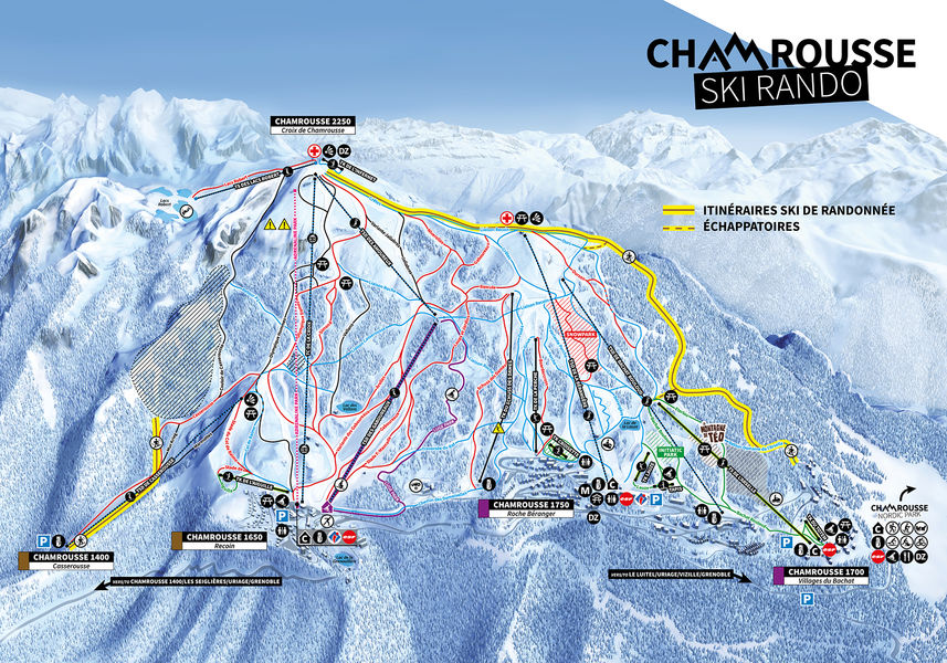
Ski touring route: Bachat-Bouloud - Croix de Chamrousse - not secured
Add to my favorites

Caution! Zone of vigilance near the route
Faucon pèlerin - du 01/02/2026 au 30/06/2026 In progress
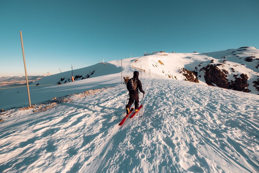
Challenging ski touring ascent to La Croix, approx. 3.5 km with 630 m vertical drop.
? New starting point: uphill bend in the Bachat-Bouloud - Chamrousse 1700 road, in front of the Skiset store.
The characteristics of the route.

Chamrousse (38)
- Distance 3.5 km
- Elevation gain 540 m
- Elevation lost 0 m
- Min. elevation 1708 m
- Max. elevation. 2246 m
- Duration (depending on pace) 2h30
- Marking Yes
Downhill skiing possible (red or blue level).
Itinerary mainly in forest from the village of Bachat-Bouloud (start) and alpine (finish).
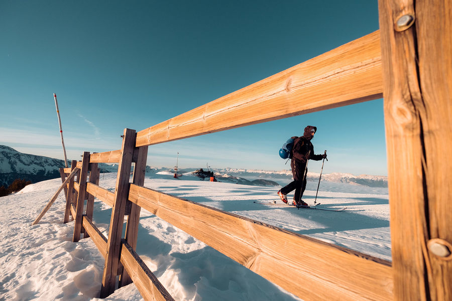
Two escape routes are possible, one close to the Ours and the other close to the Crêtes alpine slopes. Conversion not compulsory but strongly recommended.
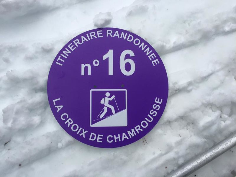
Tip: discover On Piste, an application and website to help you prepare and organize your ski touring outing or holiday, and track down the best addresses and events in sports destinations!Marking : Purple sign with ski touring pictogram and marker number.Delicate passages : Common itinerary with snowshoeing.Admission fee : Free access. "Ski touring" pass valid for two one-way trips (Casserousse chairlift, La Croix gondola, Lacs Robert chairlift) to reach les Vans. Winter 2022-23 prices: - Adult / Senior: 11€ - Child / Youth / Student: 8€ - Senior Plus: 2.80€.Opening : From 02/12 to 14/04 between 8.30 am and 6 pm. ? Do not go down the alpine ski slopes at night - danger damage winch with cable from 6pm to 8.30am. Subject to favorable snow and weather conditions.
Itinerary mainly in forest from the village of Bachat-Bouloud (start) and alpine (finish).
Two escape routes are possible, one close to the Ours and the other close to the Crêtes alpine slopes. Conversion not compulsory but strongly recommended.
Tip: discover On Piste, an application and website to help you prepare and organize your ski touring outing or holiday, and track down the best addresses and events in sports destinations!Marking : Purple sign with ski touring pictogram and marker number.Delicate passages : Common itinerary with snowshoeing.Admission fee : Free access. "Ski touring" pass valid for two one-way trips (Casserousse chairlift, La Croix gondola, Lacs Robert chairlift) to reach les Vans. Winter 2022-23 prices: - Adult / Senior: 11€ - Child / Youth / Student: 8€ - Senior Plus: 2.80€.Opening : From 02/12 to 14/04 between 8.30 am and 6 pm. ? Do not go down the alpine ski slopes at night - danger damage winch with cable from 6pm to 8.30am. Subject to favorable snow and weather conditions.
Read before you go!
Free parking on route de Bachat-Bouloud or recommended 800/900 meters away on avenue du père Tasse.
Free parking on route de Bachat-Bouloud or recommended 800/900 meters away on avenue du père Tasse.
Area : Grésivaudan
Report a problem
Website Ski touring route Bachat-Bouloud - Croix de Chamrousse - non secured Features of the application :
- Location and orientation on detailed maps thanks to the GPS of your smartphone
- Description of routes and points of interest on the route
- Photo gallery by route
- Detailed elevation profile
- Route tracking alert to warn you if you stray from the route
- Send predefined messages by SMS to your contacts
- Emergency module: trigger a call or send an emergency SMS in case of problem
- Agenda: access to events organized in the department
- News: find in the application the latest news on the web portal
- Adding achievements
- Add reports in case of problems encountered on the routes
- Share on social networks
Add your time and share your feelings
Services nearby

Arselle Peatbog (Preserved Natural Area)
Chamrousse

Romanche Museum
Livet-et-Gavet

Chamrousse Tourist Office
Chamrousse
Office Thermal et Touristique d'Uriage-les-Bains
Saint-Martin-d'Uriage

Taillefer Hut
Oulles


Information updated on 2024-01-08 by Office du Tourisme de Chamrousse


Follow us on
the digital trails
the digital trails


![]()
The Isère Outdoor application was created
by the Département de l'Isère
Infos & contact
Conseil départemental de l'Isère
7 rue Fantin Latour
CS 41096
38 022 Grenoble cedex 1
Tel. 04 76 00 38 38
 Isère Outdoor - Parcours - Ski touring route: Bachat-Bouloud - Croix de Chamrousse - not secured
Hello, world! This is a toast message.
Isère Outdoor - Parcours - Ski touring route: Bachat-Bouloud - Croix de Chamrousse - not secured
Hello, world! This is a toast message.
Isère Outdoor - Parcours - Ski touring route: Bachat-Bouloud - Croix de Chamrousse - not secured
Hello, world! This is a toast message.


OK
Annuler