Boucle vélo du Bois Français
Add to my favorites

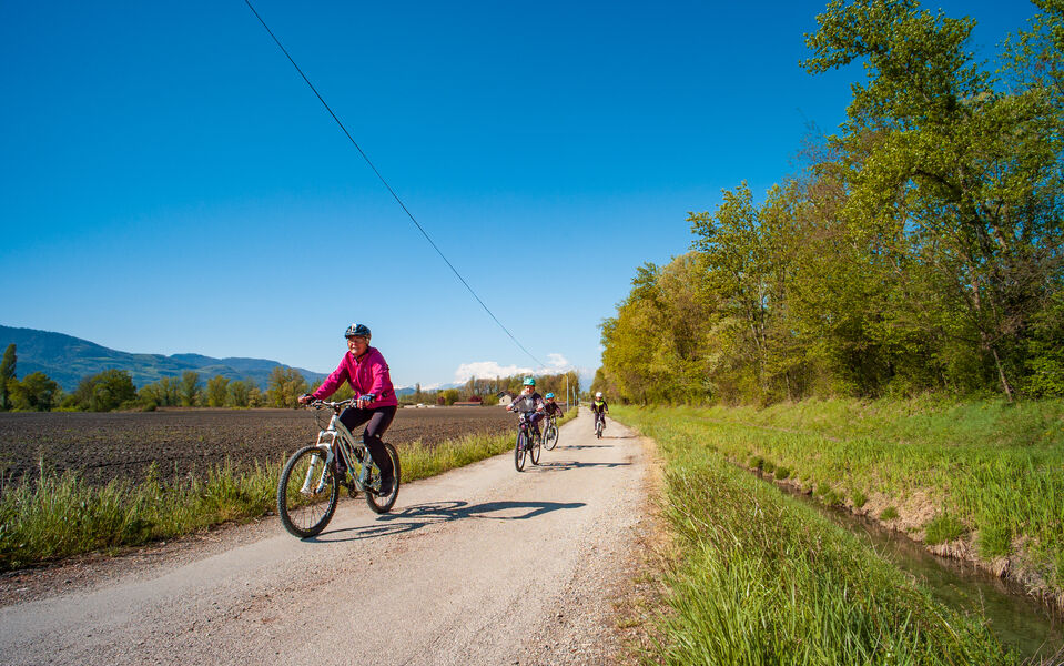
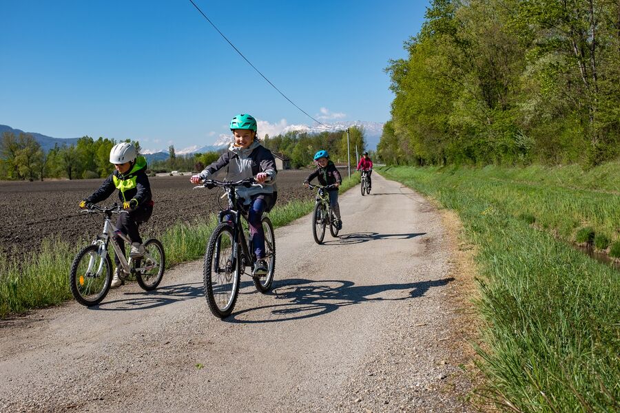
A flat loop for the whole family. Unsuitable for road bikes, it can also be ridden on gravel.
The characteristics of the route.
Meylan (38)
- Distance 15.7 km
- Elevation gain 50 m
- Elevation lost 50 m
- Min. elevation 213 m
- Max. elevation. 222 m
- Duration (depending on pace) 1h30
- Marking No
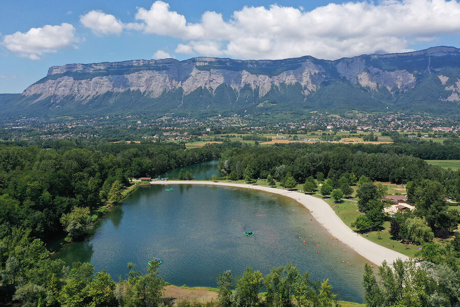
Not far from the start of the greenway along the banks of the Isère, your walk begins in the heart of the agricultural plain to the east of the Grenoble urban area. Free parking makes it easy to meet up.
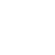
The first section of this gentle itinerary follows a stretch of greenway, allowing you to follow the Isère eastwards at your leisure. You then leave the water's edge to join the shady surroundings of the Bois Français leisure park. Finally, you'll make your way back to your starting point on little-used paths through the fields.
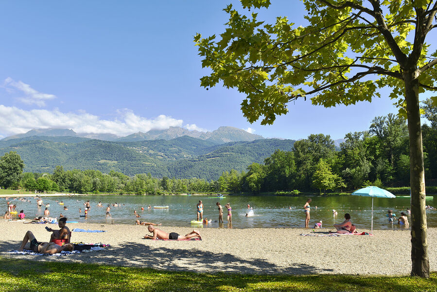
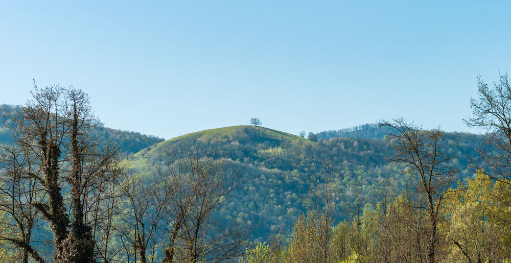
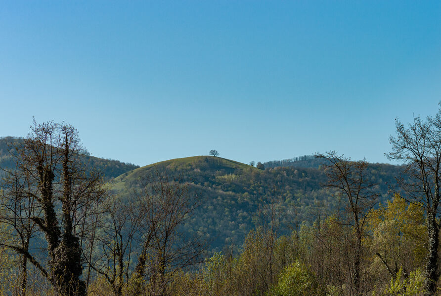
This loop is dedicated to nature lovers, who will be able to orientate their walk thanks to clearly visible landmarks. Along the banks of the Isère, on your right you'll see the Venon oak, which has guided travellers through the Grésivaudan valley for centuries. As you leave the riverbank, aim for the summit of the Dent de Crolles, then skirt the foothills of the Chartreuse massif, where the sun's shades change according to the time of day.
From the parking lot, head north up the Chemin de la Charrière d'Enfer.
Turn right onto Chemin des Agriculteurs. 170m further on, turn right again to take the greenway along the banks of the Isère, which opens up on your left, towards Domene, Bois Français, for 5km.
Leave the voie verte by turning left, allée Félix Picard, towards Bois Français. Follow the parking lots on your left, then go straight ahead on the unpaved path after the milestone.
Take the Chemin des Îles (closed by a green gate) on your left, which bends to the right 350m further on.
Turn left onto Chemin des Communaux, which runs alongside the A41 motorway.
Leave the Chemin des Communaux and continue straight ahead on the cycle path in front of you (towards Berges de l'Isère, Bois Français).
Carefully cross the Route de Domene (D11) and take the Chemin des Cantines (direction Montbonnot, Inovallée).
Continue your walk in the direction of travel on the Chemin des Agriculteurs, which runs alongside the A41 for 800m, crosses the Chantourne canal at an angle to the left, then runs alongside the A41 again.
Continue on the Chemin des Agriculteurs and then, 900m further on, on the Chemin de la Taillat, which heads south, slaloming between farm plots.
Take the Chemin de la Charrière d'Enfer on your left to reach your starting point.Equipments : Parking nearby, Admission fee : Free access.Opening : All year round. Subject to favorable weather.
The first section of this gentle itinerary follows a stretch of greenway, allowing you to follow the Isère eastwards at your leisure. You then leave the water's edge to join the shady surroundings of the Bois Français leisure park. Finally, you'll make your way back to your starting point on little-used paths through the fields.
This loop is dedicated to nature lovers, who will be able to orientate their walk thanks to clearly visible landmarks. Along the banks of the Isère, on your right you'll see the Venon oak, which has guided travellers through the Grésivaudan valley for centuries. As you leave the riverbank, aim for the summit of the Dent de Crolles, then skirt the foothills of the Chartreuse massif, where the sun's shades change according to the time of day.
From the parking lot, head north up the Chemin de la Charrière d'Enfer.
Turn right onto Chemin des Agriculteurs. 170m further on, turn right again to take the greenway along the banks of the Isère, which opens up on your left, towards Domene, Bois Français, for 5km.
Leave the voie verte by turning left, allée Félix Picard, towards Bois Français. Follow the parking lots on your left, then go straight ahead on the unpaved path after the milestone.
Take the Chemin des Îles (closed by a green gate) on your left, which bends to the right 350m further on.
Turn left onto Chemin des Communaux, which runs alongside the A41 motorway.
Leave the Chemin des Communaux and continue straight ahead on the cycle path in front of you (towards Berges de l'Isère, Bois Français).
Carefully cross the Route de Domene (D11) and take the Chemin des Cantines (direction Montbonnot, Inovallée).
Continue your walk in the direction of travel on the Chemin des Agriculteurs, which runs alongside the A41 for 800m, crosses the Chantourne canal at an angle to the left, then runs alongside the A41 again.
Continue on the Chemin des Agriculteurs and then, 900m further on, on the Chemin de la Taillat, which heads south, slaloming between farm plots.
Take the Chemin de la Charrière d'Enfer on your left to reach your starting point.Equipments : Parking nearby, Admission fee : Free access.Opening : All year round. Subject to favorable weather.
Area : Grenoble-Alpes Métropole
Report a problem
Website Pdf file Pdf file Features of the application :
- Location and orientation on detailed maps thanks to the GPS of your smartphone
- Description of routes and points of interest on the route
- Photo gallery by route
- Detailed elevation profile
- Route tracking alert to warn you if you stray from the route
- Send predefined messages by SMS to your contacts
- Emergency module: trigger a call or send an emergency SMS in case of problem
- Agenda: access to events organized in the department
- News: find in the application the latest news on the web portal
- Adding achievements
- Add reports in case of problems encountered on the routes
- Share on social networks
Sokhna
finished in 01:02:11
The 2024/09/07
En savoir plus
Ajouter votre chrono et partager vos sensations
2024/09/07 01:02:11
Sokhna
Sokhna
2024/09/07 01:02:11
Sokhna
Sokhna
Services nearby

Musée Hébert
La Tronche
Medical science museum of Grenoble
La Tronche
Resistance Museum
Grenoble
Muséum de Grenoble
Grenoble
The Grenoble Museum of arts
Grenoble


Information updated on 2024-08-21 by Office de Tourisme Grenoble Alpes


Follow us on
the digital trails
the digital trails


![]()
The Isère Outdoor application was created
by the Département de l'Isère
Infos & contact
Conseil départemental de l'Isère
7 rue Fantin Latour
CS 41096
38 022 Grenoble cedex 1
Tel. 04 76 00 38 38
 Isère Outdoor - Parcours - Boucle vélo du Bois Français
Hello, world! This is a toast message.
Isère Outdoor - Parcours - Boucle vélo du Bois Français
Hello, world! This is a toast message.
Isère Outdoor - Parcours - Boucle vélo du Bois Français
Hello, world! This is a toast message.


OK
Annuler