Walking trail: The wetlands of Chirens
Add to my favorites

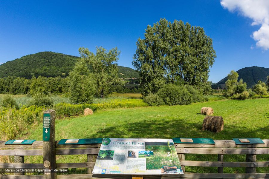
Vous vous retrouverez au fond de l’ancien lac de Chirens qui, après la fonte des glaces il y a environ 15 000 ans, s’est comblé de sédiments et de tourbe pour devenir marais. Belles vues sur l’ancienne vallée glaciaire du Val d'Ainan.
The characteristics of the route.

Chirens (38)
- Distance 10.6 km
- Elevation gain 170 m
- Elevation lost 170 m
- Min. elevation 456 m
- Max. elevation. 594 m
- Duration (depending on pace) 2h30
- Marking Yes
Equipments : Car park, Admission fee : Free access.Opening : All year round.
Area : Pays Voironnais
Report a problem
Website Pdf file Features of the application :
- Location and orientation on detailed maps thanks to the GPS of your smartphone
- Description of routes and points of interest on the route
- Photo gallery by route
- Detailed elevation profile
- Route tracking alert to warn you if you stray from the route
- Send predefined messages by SMS to your contacts
- Emergency module: trigger a call or send an emergency SMS in case of problem
- Agenda: access to events organized in the department
- News: find in the application the latest news on the web portal
- Adding achievements
- Add reports in case of problems encountered on the routes
- Share on social networks
Add your time and share your feelings
Services nearby

Pays Voironnais Tourist Office, Lake Paladru information office
Charavines

Mainssieux Museum
Voiron

Espace Naturel Sensible de l'Etang de Côte-Manin
Saint-Blaise-du-Buis
Pays Voironnais Tourist Office, Voiron information office
Voiron
Espace Naturel Sensible des Marais de la Véronnière et du Courbon
Villages du lac de Paladru


Information updated on 2023-11-09 by Office de Tourisme du Pays Voironnais


Follow us on
the digital trails
the digital trails


![]()
The Isère Outdoor application was created
by the Département de l'Isère
Infos & contact
Conseil départemental de l'Isère
7 rue Fantin Latour
CS 41096
38 022 Grenoble cedex 1
Tel. 04 76 00 38 38
 Isère Outdoor - Parcours - Walking trail: The wetlands of Chirens
Hello, world! This is a toast message.
Isère Outdoor - Parcours - Walking trail: The wetlands of Chirens
Hello, world! This is a toast message.
Isère Outdoor - Parcours - Walking trail: The wetlands of Chirens
Hello, world! This is a toast message.


OK
Annuler