Add to my favorites

The characteristics of the route.
Torchefelon (38)
- Distance 17.1 km
- Elevation gain 320 m
- Elevation lost 320 m
- Min. elevation 373 m
- Max. elevation. 610 m
- Duration (depending on pace) 6h
- Marking Yes
Features of the application :
- Location and orientation on detailed maps thanks to the GPS of your smartphone
- Description of routes and points of interest on the route
- Photo gallery by route
- Detailed elevation profile
- Route tracking alert to warn you if you stray from the route
- Send predefined messages by SMS to your contacts
- Emergency module: trigger a call or send an emergency SMS in case of problem
- Agenda: access to events organized in the department
- News: find in the application the latest news on the web portal
- Adding achievements
- Add reports in case of problems encountered on the routes
- Share on social networks
CMesona
The 2021/05/31
En savoir plus
Ajouter votre chrono et partager vos sensations
2021/05/31 CMesona
Sortie réalisée le 30 mai 2021 sous un magnifique soleil ? afin de tester l'application !
Très joli coin en effet, quelques commentaires, conseils néanmoins pour faciliter cette belle demi-journée :
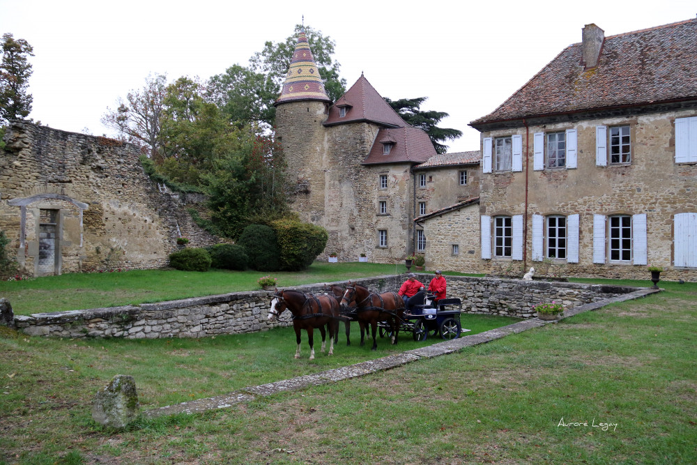
- attention, il paraît nécessaire de préciser qu'il s'agit d'un tracé attelage et non un tracé cavalier. Je m'en suis rendue compte une fois sur place et j'ai donc dû reprendre pas mal en live sinon énormément de routes et pas de passage dans la forêt de Vallin avec le tracé téléchargé contrairement à ce qui est indiqué dans le descriptif. Cela n'est pas très grave pour une sortie en plaine et il y a une multitude de jolis petits Chemins
- les chemins indiqués sont très roulants et galopants.
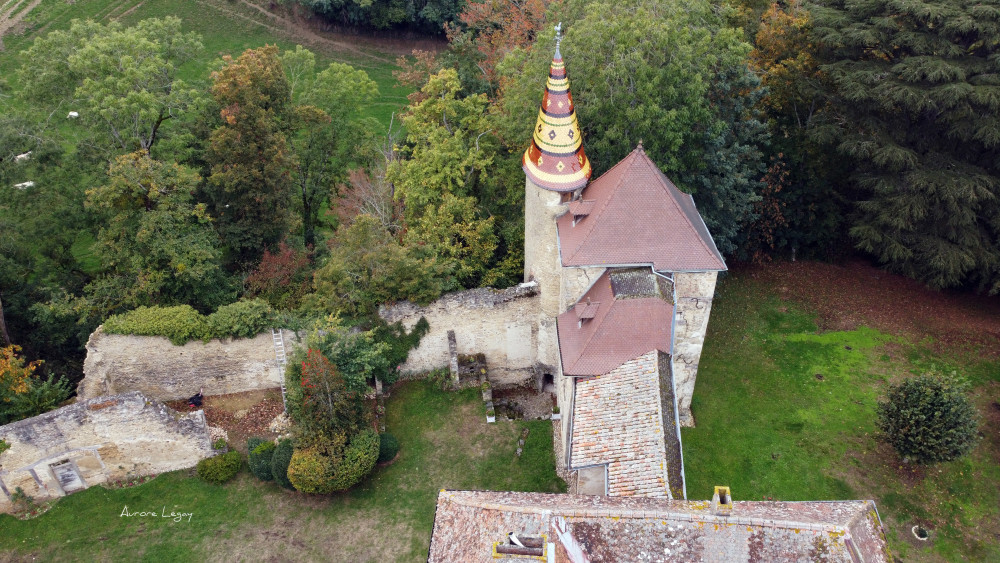
- il est possible de finir par un passage dans la forêt de Vallin qui est un peu le bouquet final de la sortie mais qui n'apparaît pas dans le tracé (cela ne passe pas en attelage à cause d'une barrière et de chemins étroits mais largement à cheval), en arrivant, possible de rentrer dans le château et d'accéder à la barre d'attache et à la visite par l'allée des grands arbres en contournant la chaîne (malgré la pancarte propriété privée), le mieux est de contacter les châtelains la veille afin qu'ils puissent l'enlever. De nôtre côté, nous avons préféré faire demi tour et revenir par la route comme prévu sur le tracé et nous avons échangé à notre retour au château avec les propriétaires très accueillants.
2021/05/31 CMesona
Sortie réalisée le 30 mai 2021 sous un magnifique soleil ? afin de tester l'application !
Très joli coin en effet, quelques commentaires, conseils néanmoins pour faciliter cette belle demi-journée :
- attention, il paraît nécessaire de préciser qu'il s'agit d'un tracé attelage et non un tracé cavalier. Je m'en suis rendue compte une fois sur place et j'ai donc dû reprendre pas mal en live sinon énormément de routes et pas de passage dans la forêt de Vallin avec le tracé téléchargé contrairement à ce qui est indiqué dans le descriptif. Cela n'est pas très grave pour une sortie en plaine et il y a une multitude de jolis petits Chemins
- les chemins indiqués sont très roulants et galopants.
- il est possible de finir par un passage dans la forêt de Vallin qui est un peu le bouquet final de la sortie mais qui n'apparaît pas dans le tracé (cela ne passe pas en attelage à cause d'une barrière et de chemins étroits mais largement à cheval), en arrivant, possible de rentrer dans le château et d'accéder à la barre d'attache et à la visite par l'allée des grands arbres en contournant la chaîne (malgré la pancarte propriété privée), le mieux est de contacter les châtelains la veille afin qu'ils puissent l'enlever. De nôtre côté, nous avons préféré faire demi tour et revenir par la route comme prévu sur le tracé et nous avons échangé à notre retour au château avec les propriétaires très accueillants.
Services nearby

Relais Cyné de Chateauvilain
Châteauvilain

Tourist information office of La Tour du Pin - Office de Tourisme des Vals du Dauphiné
La Tour-du-Pin

Etang de Gôle Sensitive Natural Area
Montcarra
Relais Cyné de Châbons
Châbons

Clog museum
Val-de-Virieu


Follow us on
the digital trails
the digital trails


![]()
The Isère Outdoor application was created
by the Département de l'Isère
Infos & contact
Conseil départemental de l'Isère
7 rue Fantin Latour
CS 41096
38 022 Grenoble cedex 1
Tel. 04 76 00 38 38
 Isère Outdoor - Parcours -
Hello, world! This is a toast message.
Isère Outdoor - Parcours -
Hello, world! This is a toast message.
Isère Outdoor - Parcours -
Hello, world! This is a toast message.


OK
Annuler