Le Ménil
Add to my favorites

Caution! Zone of vigilance near the route
Aigle royal - du 01/01/2026 au 31/08/2026 In progress
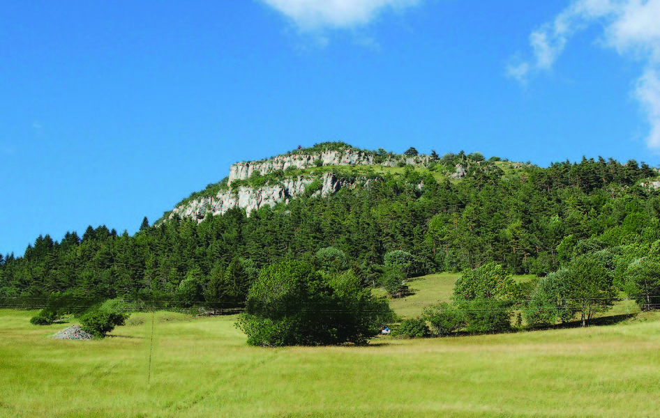
This hike, close to the village of Gresse-en-Vercors, takes you around the Rocher du Palais and offers sumptuous panoramic views of the cliffs on the eastern Vercors balconies.
Route labeled FFRandonnée

The characteristics of the route.

Gresse-en-Vercors (38)
- Distance 8.9 km
- Elevation gain 420 m
- Elevation lost 420 m
- Min. elevation 1137 m
- Max. elevation. 1451 m
- Duration (depending on pace) 3h
- Marking Yes
The ascent is gradual on a wide track to the beautiful clearing at the summit. The descent is on a pleasant forest path.Equipments : Car park, Delicate passages : Hikers should be very careful when crossing the D8A after "les Fraisses".
Use the passages provided to cross fences, and close gates and barriers.Admission fee : Free access.Opening : All year round.
Subject to favorable weather.Step by step description : Start: From the "Croix de Serre-Monet" post at the end of the parking lot (at the crossroads), head in the direction of "Les Petits Deux", passing the Grand-Veymont farm. The trail first reaches the hamlet of Grand-Deux, then turns left onto the main road to reach Les Petits-Deux. Climb the asphalt road to find the "Les Petits-Deux" signpost, then the "Col des Deux" signpost.
2) From the "Col des Deux" post, take the track on the right towards "Le Playnet". The track climbs steadily and steadily.
3) At the "Le Pleynet" post, continue along the track towards Le Ménil. There's a hairpin bend just before the summit, so keep to the main track, which ends in a clearing where you'll find the "Le Ménil" signpost. Be careful on the edge of a cliff, it can be dangerous.
4) Then head back down in the direction of "Les Fraisses", passing through the bottom of the clearing. The path is pleasant and joins the RD8a, where you'll find the "Les Fraisses" signpost.
5) Turn right on the asphalt road towards "Fruitière" and quickly climb the embankment on the left to find a path. Continue on to the hamlet of Chomeil, which you cross, then take the right-hand descent to reach the "Fruitière" signpost.
6) Continue straight ahead on the tarmac road towards "Croix de Serre-Monet". A few hundred metres further on, take the track on the left, which climbs and then follows the ridge to reach your starting point.
Area : Trièves
Report a problem
Website Pdf file Features of the application :
- Location and orientation on detailed maps thanks to the GPS of your smartphone
- Description of routes and points of interest on the route
- Photo gallery by route
- Detailed elevation profile
- Route tracking alert to warn you if you stray from the route
- Send predefined messages by SMS to your contacts
- Emergency module: trigger a call or send an emergency SMS in case of problem
- Agenda: access to events organized in the department
- News: find in the application the latest news on the web portal
- Adding achievements
- Add reports in case of problems encountered on the routes
- Share on social networks
BlorkRaider
The 2022/08/21
En savoir plus
BlorkRaider
finished in 02:45:00
The 2022/08/21
En savoir plus
Ajouter votre chrono et partager vos sensations
2022/08/21 BlorkRaider
Parcours à la portée de tous, qui alterne entre forêts et pâturages, plusieurs portions sont sur la route et certaines ne sont pas ombragées : soyez vigilants en conséquence !
2022/08/21 02:45:00
BlorkRaider
BlorkRaider
2022/08/21 BlorkRaider
Parcours à la portée de tous, qui alterne entre forêts et pâturages, plusieurs portions sont sur la route et certaines ne sont pas ombragées : soyez vigilants en conséquence !
2022/08/21 02:45:00
BlorkRaider
BlorkRaider
Services nearby

Foyer nordique de Gresse-en-Vercors
Gresse-en-Vercors

Bureau d'Informations Touristiques de Gresse en Vercors - Office de Tourisme du Trièves
Gresse-en-Vercors
Foyer nordique de Chichilianne
Chichilianne
Point d'information du Môle (Lac de Monteynard-Avignonet)
Treffort
Point d'information Chichilianne
Chichilianne


Information updated on 2025-12-18 by Isère Attractivité


Follow us on
the digital trails
the digital trails


![]()
The Isère Outdoor application was created
by the Département de l'Isère
Infos & contact
Conseil départemental de l'Isère
7 rue Fantin Latour
CS 41096
38 022 Grenoble cedex 1
Tel. 04 76 00 38 38
 Isère Outdoor - Parcours - Le Ménil
Hello, world! This is a toast message.
Isère Outdoor - Parcours - Le Ménil
Hello, world! This is a toast message.
Isère Outdoor - Parcours - Le Ménil
Hello, world! This is a toast message.


OK
Annuler